

Before And After Hurricane Maria: Satellite View Of Puerto Rico Blackout
Satellite images of Puerto Rico taken after Hurricane Maria wiped through the island nation show the devastation of the storm in one key aspect: the loss of electricity.
Several people were killed and much of the island was left without power or clean water — threatening even more fatalities — after the hurricane made landfall as a Category 4. NASA’s Earth Observatory has shared satellite images of post-hurricane Puerto Rico, with comparisons to what it looked like before the storm, that are geared toward helping first responders like the National Guard and emergency personnel like those from the Federal Emergency Management Agency.
The space agency’s Goddard Space Flight Center has linked the satellite imagery to different streets and neighborhoods. Researchers also corrected it to filter out light from the moon, clouds, light from fires, dust and haze, to make the data on electric lights as accurate as possible.
“It is critical that we get this processing done quickly, so that we can provide the cleanest and most useful imagery to the National Guard, FEMA, and other first responders,” Miguel Román, from Goddard, said in the NASA statement. “Uncorrected images can be misleading because of things like cloud cover and changing moonlight conditions.”
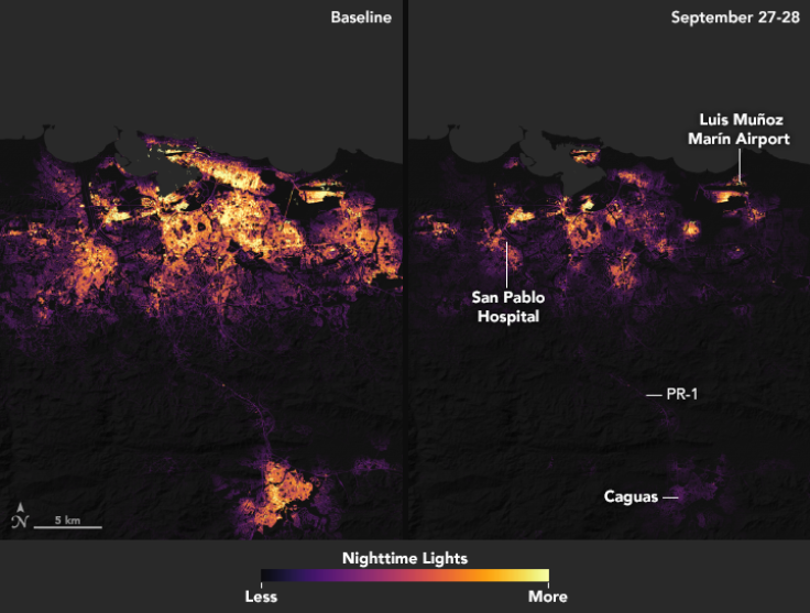
One of the ways the scientists made their satellite images more accurate is by combining data from more than one night. Although not all clouds could be removed, NASA explained that using two nights of data in an “after” shot of the Puerto Rican capital San Juan and in one of the entire country reduces the number of clouds that could obscure the view of the electric lights.
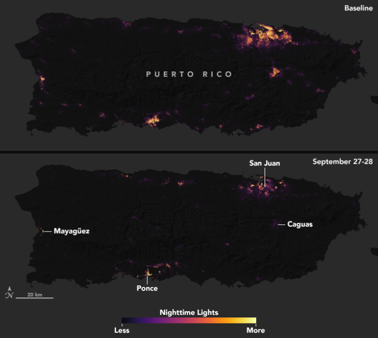
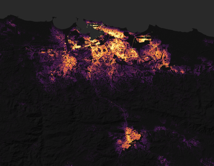
The “before” images of Puerto Rico and of San Juan show how many lights were illuminating the island on nights without many clouds or much moonlight.
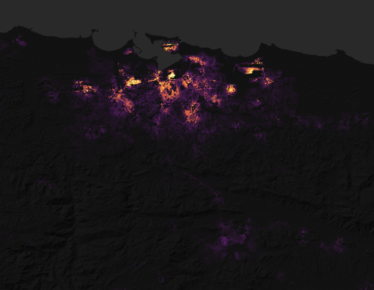
In the post-hurricane closeup of the capital, the aerial photos “show widespread outages around San Juan, including key hospital and transportation infrastructure” even several days after the storm left the island.
Having an aerial view of the electrical devastation, which came from flooding, downed trees and damage to power lines, helps organize relief efforts.
“It quickly became clear [after the hurricane] that the destruction would pose daunting challenges for first responders,” NASA said. “In circumstances like this, quickly knowing where the power is out — and how long it has been out — allows first responders to better deploy rescue and repair crews and to distribute life-saving supplies.”
In addition to static comparisons, there is an interactive map for different days in late September that allows a viewer to compare different locations before and after the hurricane, zooming in to certain areas and moving around from neighborhood to neighborhood.
Apart from the satellite imagery of the electric lights in Puerto Rico, the Earth Observatory has previously shared aerial images of how rain fell onto the island during the hurricane and how the storm changed the country’s landscape.
© Copyright IBTimes 2024. All rights reserved.
-

Ukraine, Israel, TikTok: The Massive Aid Package Before US Congress
-

Eiffel Tower Loses Sparkle For Parisians Ahead Of Olympics
-

Former Number One Momota Retires From International Badminton At 29
-

Why Insurance Prices Have Skyrocketed
-

World Bank Aiming To Connect 250 Mn Africans To Energy Grid By 2030
-

IMF Says Global Debt Levels Face 'Great Election Year' Risk
-

Divisions Among Colombia's FARC Dissidents Complicate Peace Talks
-

French Far Right Gets Youthful Vibe With 28-year-old Leader
-

US Fed's Powell Says Inflation Fight May Take 'Longer Than Expected'
-

Mideast-related Oil Price Spike Threatens 'Relatively Good' Economic Outlook: IMF Chief Economist


