

Arctic Sea Ice Reaches High Point For The Year; Now Comes The Melting Season
It might not be summer yet, but up in the Arctic, the ice is already starting to melt. On March 15, the sea ice near the northern pole reached its maximum extent for this year, shifting from a freezing period into a melting period.
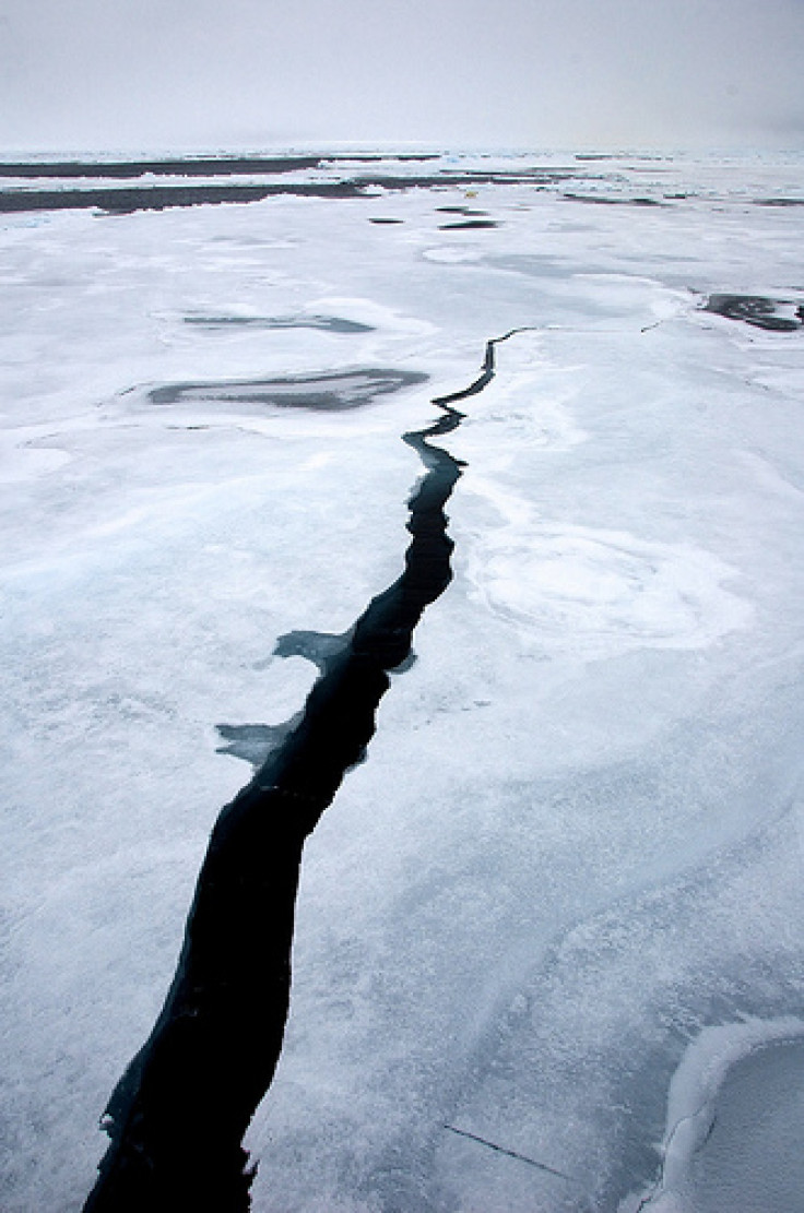
Sea ice coverage in the Arctic ebbs and flows like a yearly tide. Now, scientists say that the ice has grown as much as much as it’s going to during this annual cycle – and it didn’t get very far.
This year’s maximum stood at 15.13 million square kilometers (5.84 million square miles), according to the National Snow and Ice Data Center. This maximum is the sixth-lowest recorded sea ice extent since satellites began monitoring the Arctic. The lowest maximum sea ice coverage occurred in 2011, and the 10 lowest maximums on record have occurred over the past 10 years.
While the maximum value of ice is an important milestone, scientists are going to be paying more attention to the overall behavior of the ice in the coming months.
“The amount of ice at the maximum is a function of not only the state of the climate but also ephemeral and often local weather conditions” – like winds that push pieces of sea ice apart or together, scientist Walt Meier, said in a statement. “The monthly value [smooths] out these weather effects and so is a better reflection of climate effects.”
Since 2012, the sea ice grew 11.72 million square kilometers (4.53 million square miles) to reach the maximum – a record amount of growth, thanks to the fact that last year the sea ice coverage reached a historical low.
In August, NASA satellites found that the total amount of ice covering the Arctic Ocean was 1.58 million square miles, the smallest size ever observed since the space agency began monitoring earth's polar ice caps 30 years ago.
Some climate scientists have linked the loss of sea ice to the dramatic weather swings that the globe has been experiencing over the past few years. Scientists think losing Arctic sea ice allows the ocean and atmosphere to heat up more, which reduces the temperature difference between the equator and the North Pole. That temperature gradient in turn governs the behavior of the jetstream – the fast-moving major air current high in the atmosphere that influences most of our weather.
Reduce the temperature gradient, and the Jetstream becomes more destabilized, giving rise to more bulges and loops than normal -- so the theory goes.
"This is what is affecting the jet stream and leading to the extreme weather we are seeing in mid-latitudes," Rutgers University scientist Jennifer Francis told the Guardian on Monday.
"It allows the cold air from the Arctic to plunge much further south. The pattern can be slow to change because the [southern] wave of the jet stream is getting bigger. It's now at a near record position, so whatever weather you have now is going to stick around.”
Francis has previously linked the frigid and snowy winters of 2009-2010 and 2010-2011 to an unusually deep trough -- a southward bend in the jet stream -- hanging over the U.S. East coast and Western Europe at the time.
And a large northward bulge of the jetstream, called a ridge, is what blocked Hurricane Sandy from moving out over the Atlantic Ocean and forced it to turn back toward New Jersey last year. Some researchers think a warming climate will facilitate a more loopy jet stream that forms these big ridges more often, meaning that it could become more common for a storm system to bounce back to land after it has already begun its push out to sea.
Another potential effect of the loss of sea ice is a phenomenon called “Arctic amplification,” where the exposed, dark ocean water stores more heat energy, creating a feedback loop that melts even more ice. So, it’s probably reasonable to expect that the loss of sea ice will continue unabated, if not accelerate.
The next big question will be how low the sea ice minimum will go this summer.
Since much of the U.S. has been experiencing a cooler, snowier March than last year, you might think that would slow the melt in the Arctic. Not really, according to Meier – while recent temperatures have been cooler than normal in the Beaufort and Chukchi Seas north of Alaska, on the Atlantic side of the Arctic, temperatures have been trending warmer than normal.
Plus, cooling in certain regions will not substantially affect the sea ice coverage, he says. The primary factors influencing sea ice melting are: the amount of seasonal ice – as opposed to the stuff that sticks around for multiple years; the warmth of the spring and summer in the Arctic; and the behavior of the winds in summer, which can push the ice in different directions.
“Overall, I wouldn't expect a less dramatic melt this year due to the winter temperatures,” Meier wrote in an email.
© Copyright IBTimes 2024. All rights reserved.
-

Eiffel Tower Loses Sparkle For Parisians Ahead Of Olympics
-

Former Number One Momota Retires From International Badminton At 29
-

Why Insurance Prices Have Skyrocketed
-

World Bank Aiming To Connect 250 Mn Africans To Energy Grid By 2030
-

IMF Says Global Debt Levels Face 'Great Election Year' Risk
-

Divisions Among Colombia's FARC Dissidents Complicate Peace Talks
-

French Far Right Gets Youthful Vibe With 28-year-old Leader
-

US Fed's Powell Says Inflation Fight May Take 'Longer Than Expected'
-

Mideast-related Oil Price Spike Threatens 'Relatively Good' Economic Outlook: IMF Chief Economist
-

Wine Growers 'On Tip Of Africa' Race To Adapt To Climate Change


