Hurricane Irene Path to Reach From Florida to New York [MAPS]
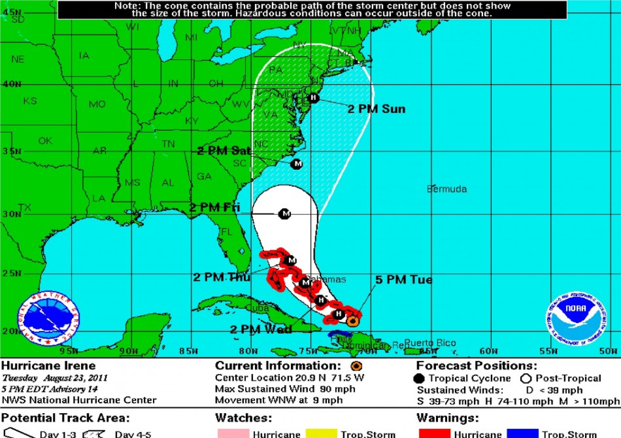
The Hurricane Irene path is expected to span almost the entire U.S. east coast, reaching all the way from Florida to as north as New York state. Strong hurricane force winds, however, are expected to spare most of the U.S.
Hurricane Irene is expected to reach off the coast of Haiti at five p.m. Tuesday, off the coast of southern Florida at two p.m. Thursday, off the coast of northern Florida by two p.m. Friday, inland Carolinas by Tuesday two p.m., and inland several north east states by two p.m. Sunday.
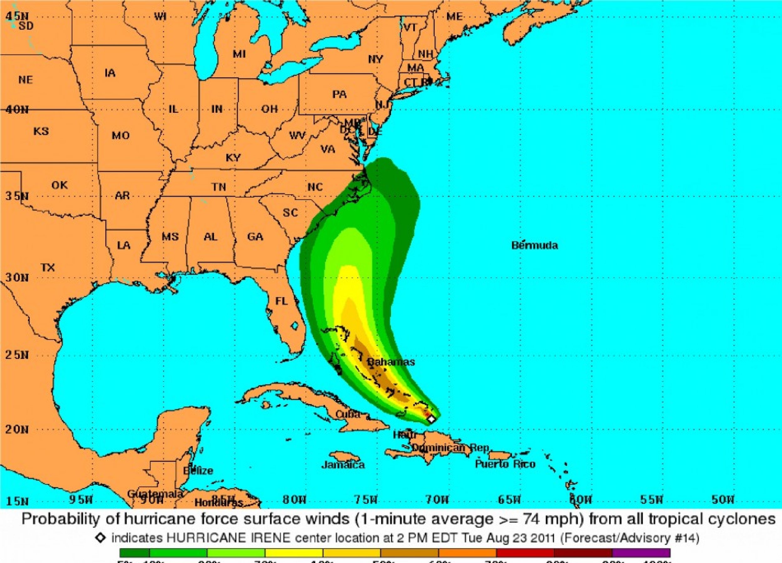
Fortunately, the Hurricane Irene path is not expected to hit much of the U.S. with hurricane force winds, defined as those with speeds more than 74 mph.
The U.S. National Hurricane Center (NHC) gives a less than 10 percent chance that hurricane force winds will clip the east coast of the Carolinas and nearly zero percent chance that such winds will spread inland beyond that.
Florida, previously expected to be affected by hurricane force winds, is now expected to be spared.
The Bahamas and nearby island countries, however, are expected to bear the brunt of Hurricane Irene's power and Hurricane warnings have been issued around that area.
Hurricane Irene's max wind speed is expected to be 110 mph on Wednesday, 125 mph on Thursday, 125 mph on Friday, 115 mph on Saturday, and 85 mph on Sunday.
As of five p.m. on Tuesday, its maximum sustained wind speed is 90 mph, according to the NHC.


© Copyright IBTimes 2024. All rights reserved.


