

NASA Helps Discover Waters Deep Under Deserts
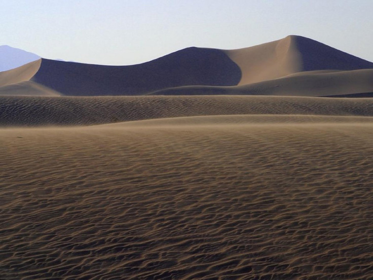
A research team from NASA has created high-resolution maps of freshwater aquifers buried deep beneath a desert in northern Kuwait by using radar sounding technology that measures underground water levels.
Originally developed to explore the subsurface of Mars, the sounding radar could help mapping regions in a desert where these aquifers are located, according to researchers, NASA said in a statement on Wednesday.
An aquifer is an underground wet layer of permeable rock from which useful groundwater can be extracted.
Researchers say the sounding radar technology could be a great help in arid regions, as it could help water managers drill “more accurately” for underground water.
The technology could locate subsurface aquifers, probe variations in the depth of the water table, and identify locations where water flowed into and out of the aquifers, NASA said.
Led by scientist Essam Heggy of NASA's Jet Propulsion Laboratory in Pasadena, Calif., the research also puts light on how climate change is affecting the deserts that cover about 20 percent of the earth’s land surface.
Much of the evidence for climate change in Earth's deserts lies beneath the surface and is reflected in its groundwater. By mapping desert aquifers with this technology, we can detect layers deposited by ancient geological processes and trace back paleoclimatic conditions that existed thousands of years ago, when many of today's deserts were wet, Heggy said.
Must Read:
© Copyright IBTimes 2024. All rights reserved.
-

Mass Cancellations Loom Despite French Air Union Cancelling Strike
-

Recycled 'Zombie' Misinformation Targets US Voters
-

Hackers Leak Part Of Source Code Of El Salvador's Bitcoin Wallet
-

Azerbaijan Says 'Closer Than Ever' To Armenia Peace Deal Amid Border Talks
-

How UK's Biggest Water Supplier Sank Into Crisis
-

Taiwan Hit By Dozens Of Strong Aftershocks From Deadly Quake
-

Gaza Health System 'Completely Obliterated': UN Expert
-

In Ecuadoran Amazon, Butterflies Provide A Gauge Of Climate Change
-

'Thank You, America:' Zelensky And Netanyahu Applaud House Passage Of Foreign Aid Package
-

Women Journalists Bear The Brunt Of Cyberbullying


