

Expected Major Tornado Outbreak In Central US Gets Under Way

A tornado touched down close to the National Weather Service's Storm Prediction Center in Norman, Okla., on Friday around 4 p.m. CDT -- the first in a series of twisters that the service's forecasters project will hit the central U.S. this weekend.
The risk of severe storms is highest on Saturday, according to the Storm Prediction Center.
No major injuries have been reported in Norman yet, but there has been damage to property, NewsOK reported. In addition, there are power outages in the vicinity, the site said.
An unidentified operator at the University of Oklahoma told Reuters that people had been warned to get to either a basement or a low floor. I was watching this tornado on TV, which was neat until I realized it was right here in Norman, said the operator.
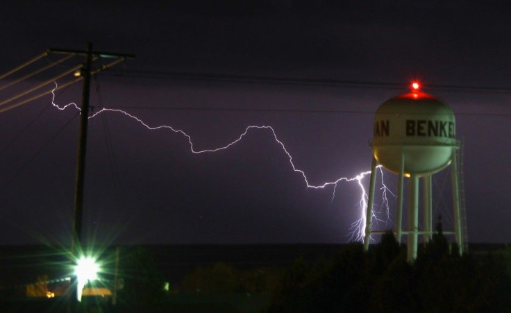
Atmospheric conditions for this weekend will be similar to those that led to the severe storms in parts of the U.S. Midwest and Southeast that killed more than 50 people last month, Steve Weiss, chief of the science support branch at the Storm Prediction Center, told Reuters. We see potentially some ... very damaging tornadoes.
Conditions could result in strong thunderstorms in Kansas and Oklahoma on Saturday, with a few so-called supercell storms characterized by rotating updrafts, Weiss told Reuters. The potential is that some of the supercells could be long-lived, so if they produce tornadoes, they could be on the ground for a while.
The forecasters' current message marks only the second time in U.S. history that the Storm Prediction Center has issued a high-risk warning more than 24 hours in advance, center director Russ Schneider told the Associated Press. The first time was in April 2006, when almost 100 tornadoes subsequently scoured the southeastern U.S.
Meanwhile, there is no guarantee the effects of the anticipated storms on Saturday would be limited to just Kansas and Oklahoma. For example, areas in Illinois, Iowa, Minnesota, Missouri, Nebraska, Texas, and Wisconsin could experience their impacts, as well.
The really dangerous part is that it looks like it's going to be overnight, Kurt Van Speybroeck, emergency response meteorologist for the National Weather Service, told Reuters. It's a really bad combination to get tornadoes at night because they're harder to see. It could be a really bad evening.
© Copyright IBTimes 2024. All rights reserved.
-

Ukraine, Israel, TikTok: The Massive Aid Package Before US Congress
-

Eiffel Tower Loses Sparkle For Parisians Ahead Of Olympics
-

Former Number One Momota Retires From International Badminton At 29
-

Why Insurance Prices Have Skyrocketed
-

World Bank Aiming To Connect 250 Mn Africans To Energy Grid By 2030
-

IMF Says Global Debt Levels Face 'Great Election Year' Risk
-

Divisions Among Colombia's FARC Dissidents Complicate Peace Talks
-

French Far Right Gets Youthful Vibe With 28-year-old Leader
-

US Fed's Powell Says Inflation Fight May Take 'Longer Than Expected'
-

Mideast-related Oil Price Spike Threatens 'Relatively Good' Economic Outlook: IMF Chief Economist


