

Four Consecutive Earthquakes Strike Guatemala Within 90 Minutes
Four earthquakes of magnitudes 5.8, 4.5 and 4.8 struck southern Guatemala Monday followed by two aftershocks of magnitudes 4.3 and 4.6 early Tuesday.
The four earthquakes struck Guatemala continuously within 90 minutes, shaking buildings in the capital, triggering landslides and killing three people.
The highest magnitude of the four earthquakes was recorded 5.8 on Richter scale that hit Guatemala at a depth of 39.4 km (24.5 miles) on Sept. 19, 2011, at 18:34:00 UTC, according to United States Geological Survey (USGS).
The epicenter of the quake was located at 53 km (32 miles) south east of Guatemala’s capital in Central America.
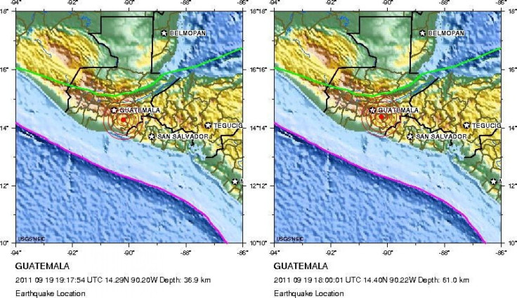
The two 4.8 magnitudes earthquakes that occurred at 18:00:01 and 19:17:54 UTC were also located around 41 to 51 kilometers south east of Guatemala City.
A 4.5 magnitude earthquake that struck at 20:30:04 UTC was found to be located at 60 km (37 miles) east of south east of Escuintla, Guatemala.
Cities of Los Esclavos, 65 km (40 miles) from Guatemala City and Cuilapa were affected the most where people were injured and displaced by earthquakes and aftershocks.
Two aftershocks in the region were further reported during the early hours of Sept. 20.
A 4.6 magnitude earthquake occurred at a depth of 24 km (14.9 miles) at 04:28:52 UTC, while another aftershock of magnitude 4.3 struck at a depth of 40.1 km (24.9 miles) at 00:22:52 UTC on Tuesday.
Both the aftereffects were located south east of Guatemala City at about 51 to 64 kilometers.
© Copyright IBTimes 2024. All rights reserved.
-

Bitcoin And Crypto Price Review - Another Myth Gets Busted?
-

Mass Cancellations Loom Despite French Air Union Cancelling Strike
-

Mired In Crisis, Boeing Reports Another Loss
-

Recycled 'Zombie' Misinformation Targets US Voters
-

Hackers Leak Part Of Source Code Of El Salvador's Bitcoin Wallet
-

Azerbaijan Says 'Closer Than Ever' To Armenia Peace Deal Amid Border Talks
-

How UK's Biggest Water Supplier Sank Into Crisis
-

Taiwan Hit By Dozens Of Strong Aftershocks From Deadly Quake
-

Gaza Health System 'Completely Obliterated': UN Expert
-

In Ecuadoran Amazon, Butterflies Provide A Gauge Of Climate Change


