

Hurricane Irene 2011 Threatens U.S. East Coast: How to Prepare

Hurricane Irene, the first hurricane of 2011, could reach the U.S. coast as early as Thursday, when it is expected to be a much stronger storm system than it is now, The Weather Channel has reported.
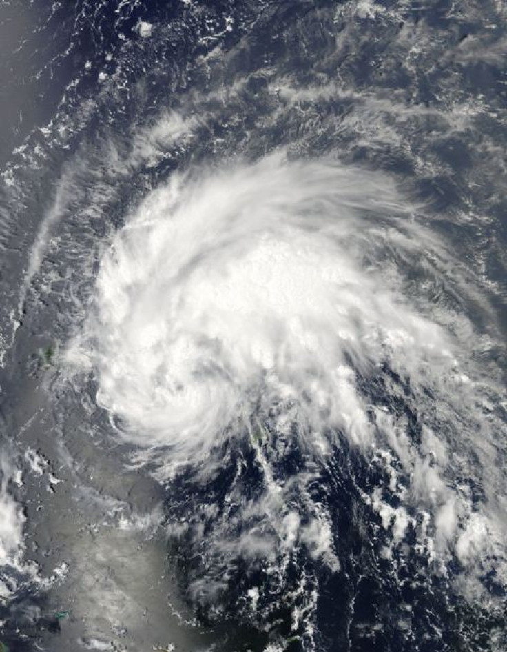
Tropical storm warnings for Puerto Rico, Vieques and Culebra were discontinued Monday afternoon after the storm moved west-northwest towards the Dominican Republic. If the storm remains on its current path, Irene is expected to reach Dominican Republic and Haiti Monday, land near or over the Turks and Caicos Islands and the southeastern Bahamas on Tuesday, and hit central Bahamas early Wednesday.
Irene is expected to become a major hurricane, with wind speeds in excess of 110 mph, by Thursday morning.
The Weather Channel increased the threat to Florida and the Southeast U.S. to High on Monday. Most of the Bahamas is under Extreme threat. Although it is possible the storm will reach the U.S. coast on Thursday, the highest probability of U.S. landfall is in the Carolinas on Friday night into Saturday. This is all subject to change as the storm's path changes direction and the storm increases (or decreases) in strength.
As of Monday afternoon, the extreme coastal areas of the U.S. from the tip of Florida to north of Wilmington, N.C., were designated with a hurricane threat level of High; with areas just inland also given threat warnings.
Hurricane experts at The Weather Channel recommend that anyone in the storm's projected path make sure that their home meets building code requirements for high-wind regions. If there are any potential weaknesses, residents can improve a structure's readiness themselves, by cutting down dead trees and trimming weak branches that could fall on a home. Replacing gravel pathways with shredded bark can also minimize potential damage from flying rocks.
If you do not have impact-resistant window systems, it is recommended that you get new windows, but if that is not possible, you can install impact-resistant shutters to prevent potential flying debris from breaking through windows.
The same goes for sliding glass doors, which are more vulnerable to storm damage than other doors. If you do not have impact-resistant sliding glass doors, consider covering the door with shutters made of plywood or oriented strand board.
It is a good idea to remove anything from a yard that could potentially become flying debris and crash through windows or doors.
Meteorologists are particularly concerned about what they call hurricane preparedness complacency in 2011, since only four hurricanes have made landfall since the last big hurricane season of 2005.
Visit The Weather Channel's website for detailed instructions on how to prepare for Hurricane Irene.
© Copyright IBTimes 2024. All rights reserved.
-

French Air Traffic Controller Strike Threatens Flight Chaos
-

Azerbaijan Says 'Closer Than Ever' To Armenia Peace Deal Amid Border Talks
-

How UK's Biggest Water Supplier Sank Into Crisis
-

Taiwan Hit By Dozens Of Strong Aftershocks From Deadly Quake
-

Gaza Health System 'Completely Obliterated': UN Expert
-

In Ecuadoran Amazon, Butterflies Provide A Gauge Of Climate Change
-

50 Years On, Vintage Vehicles To Reenact Portugal's Carnation Revolution
-

Conflicts Push Military Spending To 'All-time High': Report
-

'Thank You, America:' Zelensky And Netanyahu Applaud House Passage Of Foreign Aid Package
-

Women Journalists Bear The Brunt Of Cyberbullying


