Hurricane Irene Path Leaves Damage and Spurs Preparation

Hurricane Irene's path has left damages behind it and spurred emergency preparations ahead of it.
As of 5 p.m. ET on Saturday, it was headed north off the coast of North Carolina with a maximum sustained wind speed of 80 mph.
It left behind several fatalities on its path, mostly in North Carolina. Moreover, over 900,000 households, mostly in Virginia and North Carolina, are without power, according to AP.
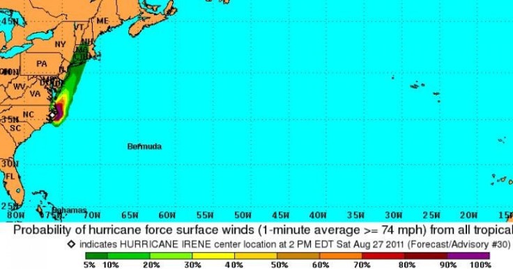
The latest map from the National Hurricane Center (left) shows there is a 5 to 10 percent chance that hurricane force surface winds, defined as those above 74 mph, will hit the coast of multiple states on the East Coast.
With Hurricane Irene already impacting or threatening to do so soon, millions in the East Coast have evacuated hours or even days ago.
Many states, like New York, New Jersey, and Connecticut, have issued mandatory evacuation orders for certain coastal areas.
New York City, for example, has ordered residents in certain neighborhoods to evacuate by 5 p.m. For those who cannot find accommodation with friends and family, New York City Mayor Michael Bloomberg has set up 91 public shelters.
New York City also shut down mass transit at noon and warned that Consolidated Edison may shut off electricity in Lower Manhattan if flooding becomes a concern.
Massachusetts Governor Deval Patrick, meanwhile, has declared a state of emergency and deployed 2,500 National Guard troops.
Despite evacuation orders and warnings to stay inside, officials are still worried their advice and orders are unheeded.
In North Carolina, at least one death occurred while the victim was outside his home. The New York Times reported that many Rockaway peninsula residents have ignored mandatory evacuation orders.
© Copyright IBTimes 2024. All rights reserved.


