

Hurricane Katia, Tropical Storm Nate, Tropical Storm Maria Prompt Public Advisories
Tropical Storm Nate is brewing trouble in the Gulf of Mexico, while Hurricane Katia is set to disturb Bermuda and the U.S. East coast and Tropical Storm Maria continues to travel through the Atlantic Ocean.
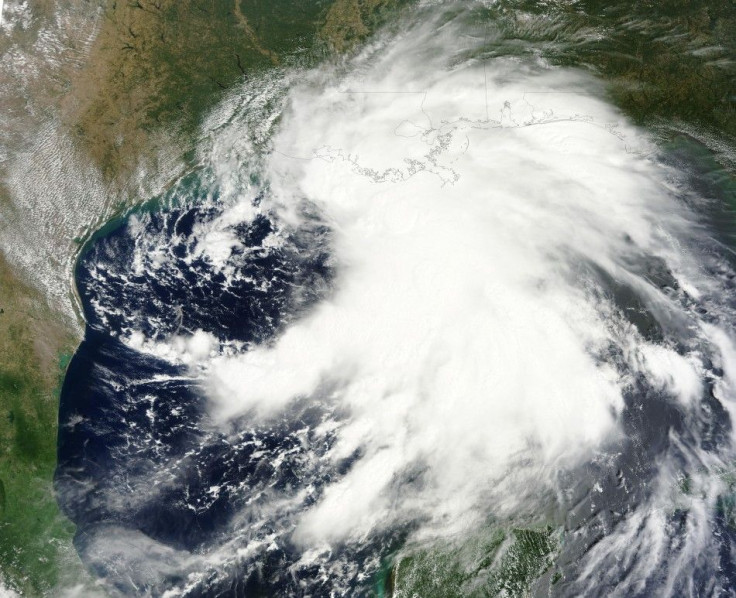
Nate is hovering over the Bay of Campeche in southeastern Mexico. The Mexican government has issued warnings along the coastline, Reuters reported.
The National Hurricane Center has noted that Nate is almost stationary over the bay. It is expected to produce 2 to 4 inches of rain in the states of Campeche, Tabasco, and southern Veracruz. Some areas may receive up to 8 inches of rain.
Hurricane Katia is a Category 1 hurricane with maximum sustained winds near 80 miles per hour, the NHC reported.
Katia is generating large swells on Bermuda and on the East coast of the U.S., according to the NHC. Bermuda also has a tropical storm watch.
The NHC anticipates little change in Katia's strength over the next 48 hours. The NHC did warn that swells produced by Katia may cause dangerous surf and rip current conditions.
Tropical Storm Maria is heading west across the Atlantic but has not prompted any warnings or watches. It is predicted to continue heading west rapidly but is expected to slow down after 24 hours.
© Copyright IBTimes 2024. All rights reserved.
-

Ukraine, Israel, TikTok: The Massive Aid Package Before US Congress
-

Eiffel Tower Loses Sparkle For Parisians Ahead Of Olympics
-

Former Number One Momota Retires From International Badminton At 29
-

Why Insurance Prices Have Skyrocketed
-

World Bank Aiming To Connect 250 Mn Africans To Energy Grid By 2030
-

IMF Says Global Debt Levels Face 'Great Election Year' Risk
-

Divisions Among Colombia's FARC Dissidents Complicate Peace Talks
-

French Far Right Gets Youthful Vibe With 28-year-old Leader
-

US Fed's Powell Says Inflation Fight May Take 'Longer Than Expected'
-

Mideast-related Oil Price Spike Threatens 'Relatively Good' Economic Outlook: IMF Chief Economist


