

Jason-1 Ocean Tracking Satellite Is Dead, Will Float Lifelessly In Orbit For 1,000 Years

The long-running Jason-1 ocean altimetry satellite, which was used to measure the rise and fall in ocean levels for more than 11 years, was finally decommissioned earlier this week after ground stations lost contact with the satellite on June 21.
Jason-1, the product of a successful joint venture between NASA and Centre National d'Etudes Spatiales, or CNES, dropped out of sight of ground stations once contact was lost. And, after multiple failed attempts by U.S. and French ground stations to re-establish communication with the satellite, it was determined that a non-recoverable failure with Jason-1’s last remaining transmitter had resulted in the loss of contact.
"Jason-1 has been a resounding scientific, technical, and international success," John Grunsfeld, associate administrator at NASA's Science Mission Directorate, Washington, said in a statement on Wednesday. "Since launch, it has charted nearly 1.6 inches (4 centimeters) of rise in global sea levels, a critical measure of climate change and a direct result of global warming."
The satellite’s other transmitter permanently broke down in September 2005, and with the most recent failure of the remaining transmitter, there is now no way to recover data from Jason-1, according to NASA.
After putting the satellite into a safe-hold state on Monday, mission controllers at CNES and NASA again tried to locate a signal but Jason-1 did not respond, and authorities decided to decommission it by turning off the satellite’s control systems, which helped keep its solar panels pointed at the sun.
NASA said that as Jason-1’s solar panels drift away from the sun, its batteries will discharge and leave the satellite totally lifeless within the next 90 days. An inert Jason-1 will then float in orbit for at least 1,000 years before re-entering Earth's atmosphere.
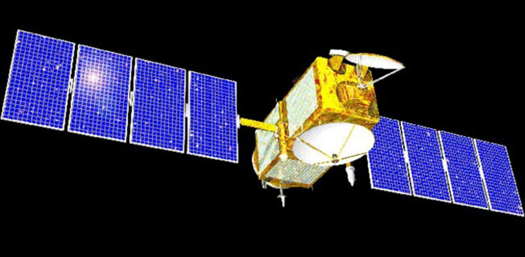
Considered as “a superstar of the satellite oceanography world,” Jason-1 had been tracking ocean levels for more than 11 years. Launched on Dec. 7, 2001, and designed to last only three to five years, the satellite precisely mapped sea level, wind speed and wave height for more than 95 percent of Earth's ice-free oceans every 10 days. It helped collect crucial information on ocean circulation, which enabled more accurate weather, ocean and climate forecasts.
During its mission, Jason-1 collaborated with its predecessor, TOPEX/Poseidon launched in 1992, and its successor, Jason-2, launched in 2008.
"Like its predecessor TOPEX/Poseidon, Jason-1 provided one of the most comprehensive pictures of changes in the tropical Pacific Ocean, including the comings and goings of El Nino and La Nina events," Lee-Lueng Fu, Jason-1 project scientist at NASA's Jet Propulsion Laboratory in Pasadena, Calif., said.
"These Pacific Ocean climate cycles are responsible for major shifts in sea level, ocean temperatures and rainfall every two to five years and can sometimes be so large that worldwide weather patterns are affected. Jason-1 data have been instrumental in monitoring and predicting these ever-changing cycles."
Meanwhile, the Jason-2 mission still continues to operate in good health, while its successor Jason-3 is gearing up for a launch in March 2015.
© Copyright IBTimes 2024. All rights reserved.
-

Eiffel Tower Loses Sparkle For Parisians Ahead Of Olympics
-

Former Number One Momota Retires From International Badminton At 29
-

World Bank Aiming To Connect 250 Mn Africans To Energy Grid By 2030
-

IMF Says Global Debt Levels Face 'Great Election Year' Risk
-

Divisions Among Colombia's FARC Dissidents Complicate Peace Talks
-

French Far Right Gets Youthful Vibe With 28-year-old Leader
-

US Fed's Powell Says Inflation Fight May Take 'Longer Than Expected'
-

Mideast-related Oil Price Spike Threatens 'Relatively Good' Economic Outlook: IMF Chief Economist
-

Wine Growers 'On Tip Of Africa' Race To Adapt To Climate Change
-

Despite Olympic Truce, Games Wrestle With Political Fallout


