

More extreme weather in store across U.S.
More extreme weather was expected across the country on Sunday, as parts of the Midwest and Northeast faced possible flooding from slow-moving storms while blistering triple-digit temperatures were expected in coastal Southeastern states.
A strong, westerly wind flowing down from the Appalachian Mountains will briefly push temperatures in Virginia, the Carolinas and Georgia over the century mark in the afternoons on Sunday and Monday, according to AccuWeather.com.
The temperature will feel like 110 to 115 degrees Fahrenheit with the humidity.
After dumping rains on the Bahamas, the remnants of former Tropical Storm Emily moved into the open Atlantic and away from the U.S. East Coast on Sunday as a tropical depression.
The remaining clouds and thunderstorms carried top sustained winds of 35 miles per hour with little change in strength expected over the next 24 hours, the U.S. National Hurricane Center said.
AccuWeather.com meteorologists predicted a stormy day in the Midwest and Northeast, with the I-95 corridor from the Baltimore area north to New York City seen as particularly vulnerable to flooding from heavy rains.
"Because many in this region experienced heavy rain on Saturday and overnight, the threat for flooding in low-lying and poor drainage areas will be elevated as any heavy shower or storm rolls through," AccuWeather.com meteorologist Bill Deger said on the website.
The American Red Cross on Sunday said nearly 100 homes had been damaged by flash floods in Charlotte, North Carolina, on Friday.
Authorities had recovered the bodies of a 43-year-old woman and her 16-year-old daughter, who appeared to have drowned in a creek swollen by heavy rains in east Charlotte.
HIGH HEAT CONTINUES
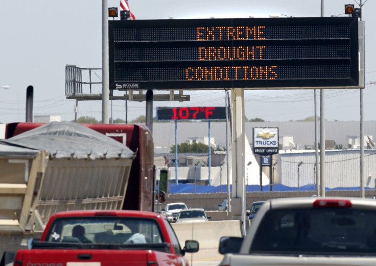
Heat advisories remain in effect in the South and Central Plains, which have been baking for weeks in high heat that shows little sign of subsiding.
In New Orleans, organizers of the annual music festival honoring jazz legend Louis "Satchmo" Armstrong dubbed the event as "Satchmo in the Shade" this weekend after erecting massive tents to help keep attendees cool in the 90-degree heat.
Temperatures well into the triple digits are forecast over a large area of central and western Texas for the coming week.
The Weather Channel predicts highs by midweek of 109 degrees in the Dallas-Fort Worth area, which already has sweltered through 36 consecutive days of temperatures topping 100 degrees.
The state's power grid is being pushed to the limit by the widespread nature of the heat. Residents are being urged to turn their air conditioning units up to 80 degrees and avoid using appliances such as dishwashers or laundry equipment, especially during the late afternoon.
"They are not only your hottest times of the day, but they are also the times of the day when not only is the workplace still active, but people are heading home and using more electricity there as well," said Terry Hadley, a spokesman for the Public Utility Commission of Texas.
Meanwhile, parts of the Midwest are on the verge of breaking out of the prolonged heat grip, the National Weather Service said.
In Kansas City, Missouri, where the city's health department says 24 people have died this summer from heat-suspected causes, the forecasted high of 95 degrees on Sunday is expected to give way to highs in the middle to low 80s for the rest of the week starting Monday.
© Copyright Thomson Reuters 2024. All rights reserved.
-

Eiffel Tower Loses Sparkle For Parisians Ahead Of Olympics
-

Former Number One Momota Retires From International Badminton At 29
-

Why Insurance Prices Have Skyrocketed
-

World Bank Aiming To Connect 250 Mn Africans To Energy Grid By 2030
-

IMF Says Global Debt Levels Face 'Great Election Year' Risk
-

Divisions Among Colombia's FARC Dissidents Complicate Peace Talks
-

French Far Right Gets Youthful Vibe With 28-year-old Leader
-

US Fed's Powell Says Inflation Fight May Take 'Longer Than Expected'
-

Mideast-related Oil Price Spike Threatens 'Relatively Good' Economic Outlook: IMF Chief Economist
-

Wine Growers 'On Tip Of Africa' Race To Adapt To Climate Change


