

NASA Mars Image Dump: Massive Cache Of Over 1,000 Images Captured By Mars Reconnaissance Orbiter Published

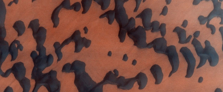
NASA’s Mars Reconnaissance Orbiter (MRO) has been orbiting the red planet since 2006, beaming striking photos of Mars back to Earth every month. On Tuesday, the space agency published its largest dump of images captured by the MRO’s HiRise camera, releasing a cache of over 1,000 photos that show the Martian surface in all its glory — from dunes and craters to mountains and ice caps.
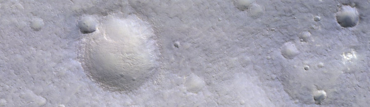

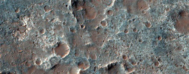
The images were captured by the HiRise —High Resolution Imaging Science Experiment — camera on board the MRO. The Key to capturing such stunning images? Perfect lighting.
The photos were taken in May, when the red planet experienced its equinox — a period during a planet’s orbit when the sun shines directly on its equator, lighting up both its poles. Coincidentally, as Alfred McEwen, the director of the Planetary Image Research Laboratory, explains to Popular Science, this time, the equinox overlapped with the period when Mars and the sun were on the opposite sides of Earth — a phenomenon that facilitates unobstructed communication between the MRO and ground control.
As a result, the satellite was able to send a hefty amount of data — in this case, high-quality images — in a short period of time.
The images can be used by NASA to find out the best landing sites for InSight spacecraft. The robotic lander, which is scheduled for launch in May 2018, is part of NASA’s ambitious Mars exploration program, which aims to eventually put humans on the red planet.
The two-year InSight Mission — which stands for Interior Exploration using Seismic Investigations, Geodesy and Heat Transport — aims to understand, through a thorough investigation of Mars’ deep interior, how all rocky planets in our solar system, including Earth, formed and evolved.
The entire collection of images captured by the HiRise camera can be viewed here.
© Copyright IBTimes 2024. All rights reserved.
-

IMF Says Global Debt Levels Face 'Great Election Year' Risk
-

Divisions Among Colombia's FARC Dissidents Complicate Peace Talks
-

French Far Right Gets Youthful Vibe With 28-year-old Leader
-

Mideast-related Oil Price Spike Threatens 'Relatively Good' Economic Outlook: IMF Chief Economist
-

Wine Growers 'On Tip Of Africa' Race To Adapt To Climate Change
-

Despite Olympic Truce, Games Wrestle With Political Fallout
-

What Will The Fed Do With The Latest Inflation Numbers?
-

US Retail Sales Up More Than Expected In March
-

Alexandre De Moraes: Brazil Judge In Feud With Elon Musk
-

Paris 2024 Games Flame To Be Lit In Ancient Olympia


