

NASA Satellite Gets Images Of Snowstorm
NASA's Geostationary Operational Environmental Satellite captured some striking images of the winter storm that buried parts of the northeastern U.S. over the weekend.
As the snow stops falling, the satellite images show the snow cover on the ground. Gusts of wind still make the temperature feel colder than it is, but the National Weather Service says in its forecasts that it will get slightly warmer - a few degrees above freezing - by New Year's Eve.
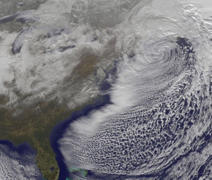
The GOES-13 satellite captured an image of the low pressure system's center off the Massachusetts coast and saw the snowfall left behind.
The GOES-13 satellite is operated by the National Oceanic and Atmospheric Administration and NASA's GOES Project at the Goddard Space Flight Center in Greenbelt, Md. The images and animations are created there.
As of 1:30 p.m. Eastern Time on Monday, all blizzard warnings were canceled as the low pressure system has pulled much of its snow and rain away from land areas and into the North Atlantic Ocean. The winds behind the system are gusting but thus far have not caused major problems for the region.
Snowfall ranged from 1.5 inches in Atlanta, Georgia -- a rarity at any time of year -- to more than a foot in various areas of New Jersey, New York and the New England states.
© Copyright IBTimes 2024. All rights reserved.
-

IMF Says Global Debt Levels Face 'Great Election Year' Risk
-

Divisions Among Colombia's FARC Dissidents Complicate Peace Talks
-

French Far Right Gets Youthful Vibe With 28-year-old Leader
-

US Fed's Powell Says Inflation Fight May Take 'Longer Than Expected'
-

Mideast-related Oil Price Spike Threatens 'Relatively Good' Economic Outlook: IMF Chief Economist
-

Wine Growers 'On Tip Of Africa' Race To Adapt To Climate Change
-

Despite Olympic Truce, Games Wrestle With Political Fallout
-

What Will The Fed Do With The Latest Inflation Numbers?
-

US Retail Sales Up More Than Expected In March
-

Alexandre De Moraes: Brazil Judge In Feud With Elon Musk


