NASA Tracks Tropical Storm Emily from Space (IMAGES)
The island of Haiti is bracing itself for Tropical Storm Emily, which is expected to hit soon.
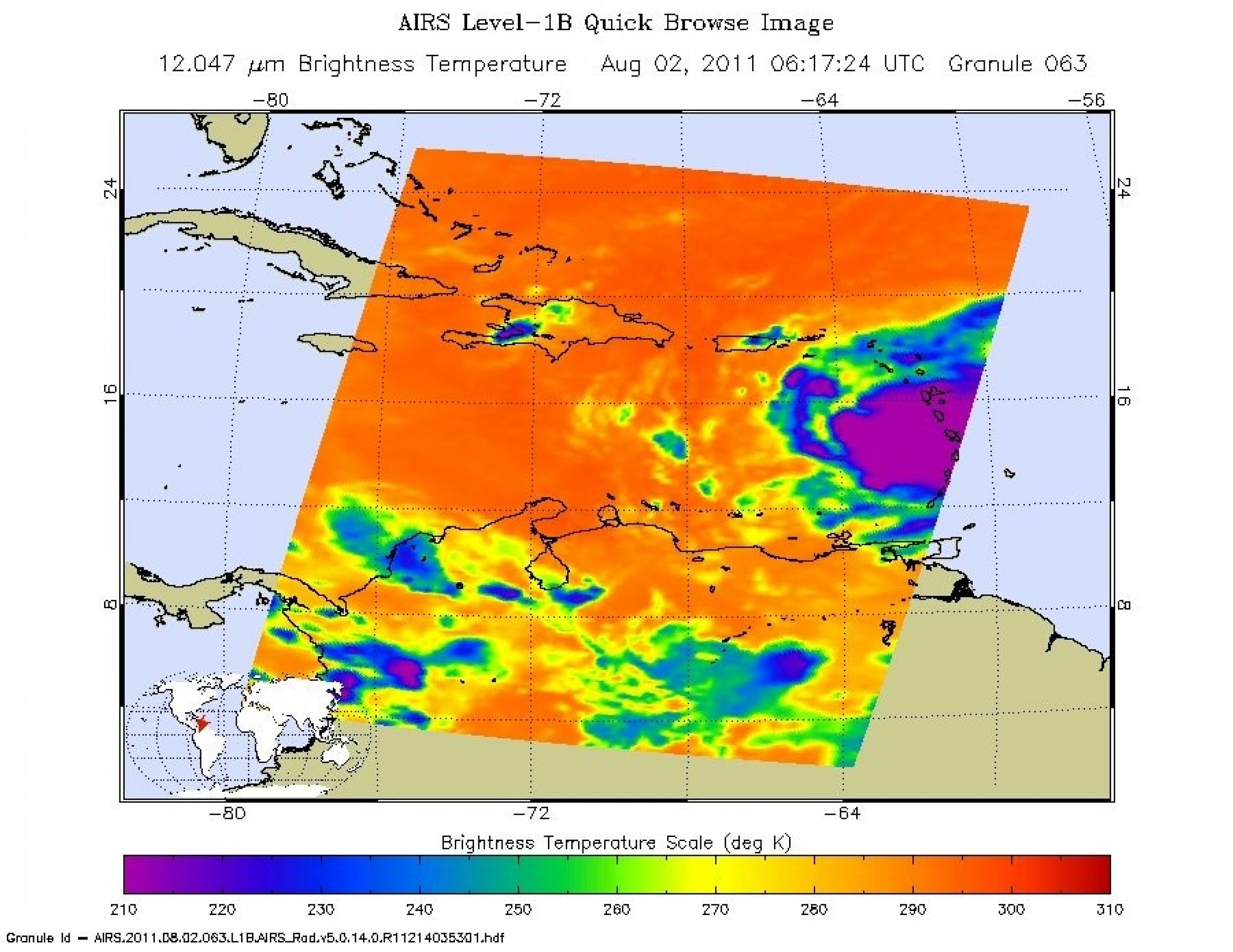
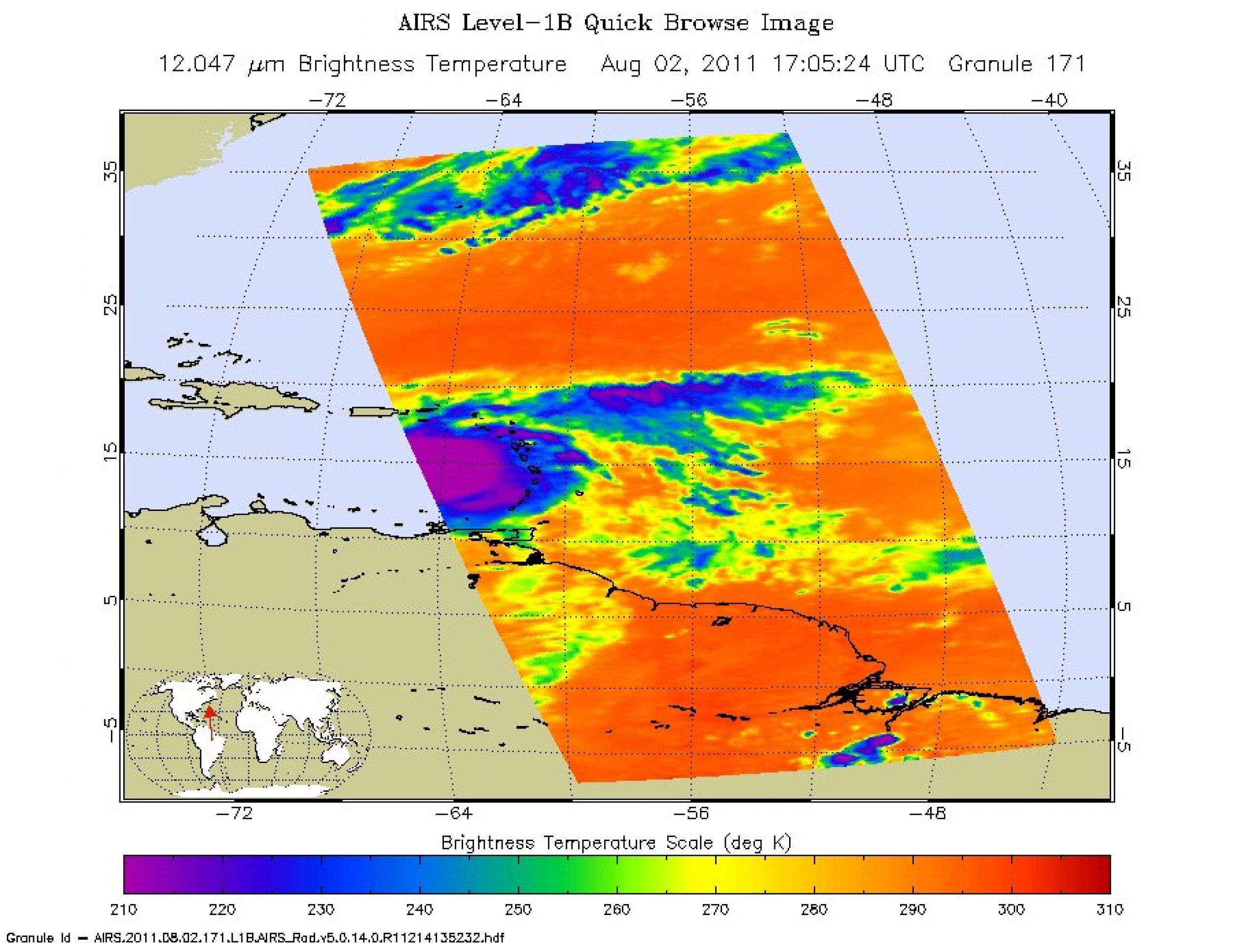
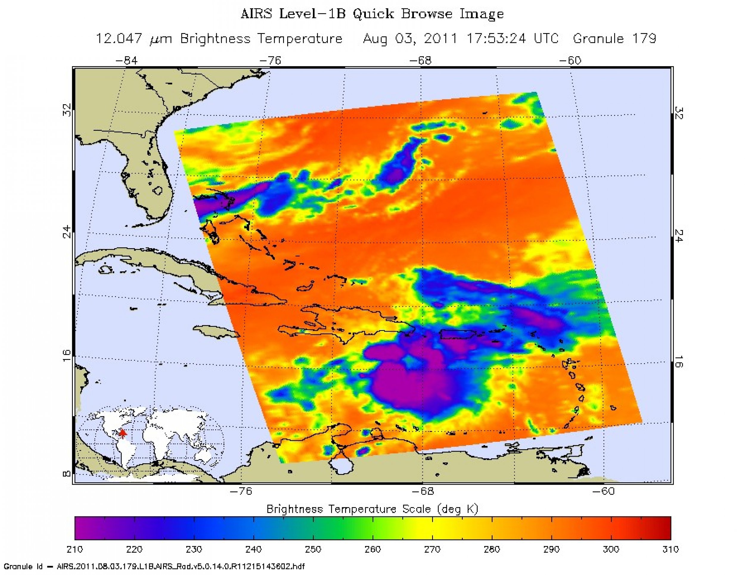
NASA has tracked the storm from space using several satellite images. The Atmospheric Infrared Sounder (AIRS) instrument on NASA's Aqua spacecraft captured an infrared image of Emily on Aug. 3 at 1:53 eastern. At that point, the storm was located 125 miles (201 kilometers) south of Santo Domingo, Dominican Republic.
According to NASA, Emily is moving at 14 miles per hour (12 knots) with maximum winds of 50 miles per hour (45 knots). Luckily for Haitians, Dominican Republicans and others in the affected areas, the storm will likely weaken as it approaches.
However, as it passes through the Bahamas and off the U.S. east coast, weather forecasters expect it to resume a slow strengthening trend.
Emily will likely bring torrential rains to the area, roughly 6 to 12 inches (15 to 30 centimeters) with possibility of up to 20 inches (51 centimeters) possible in places. Haiti and other countries in the area are worried about life-threatening flash floods and mudslides.
Any kind of natural disaster would be terrible for Haiti, which is still recovering from the Earthquake which ravaged it last year. More than 600,000 people in the country are still without a home after the earthquake.
NASA says the AIRS data creates an accurate 3-D map of atmospheric temperature, water vapor and clouds, data which is useful to forecasters. In the image, the coldest cloud-top temperatures appear in purple, indicating towering cold clouds and heavy precipitation.
NASA has released three of these satellite images of Emily from the past three days. You can check those out below.
The space agency has also set up a Twitter account, which tracks storms like Emily.


© Copyright IBTimes 2024. All rights reserved.


