Sharper NASA Images of Lunar Surface Reveal Trails Left by Humans (PHOTOS, VIDEO)
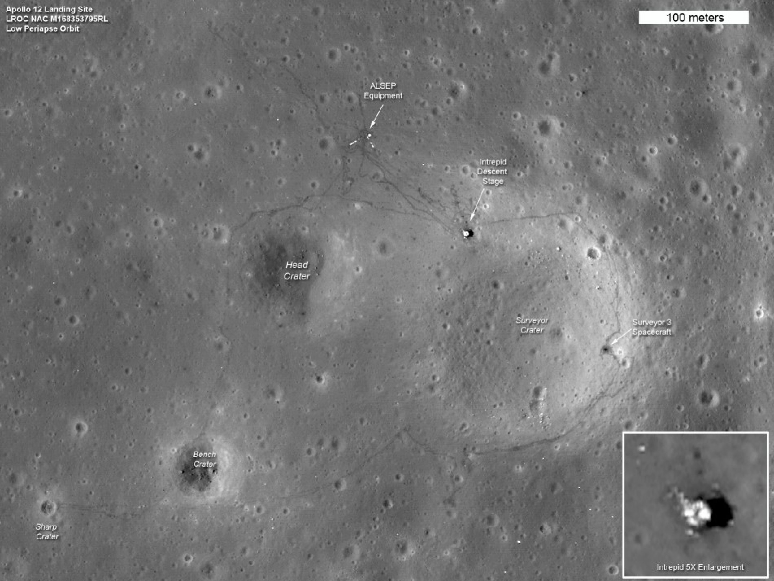
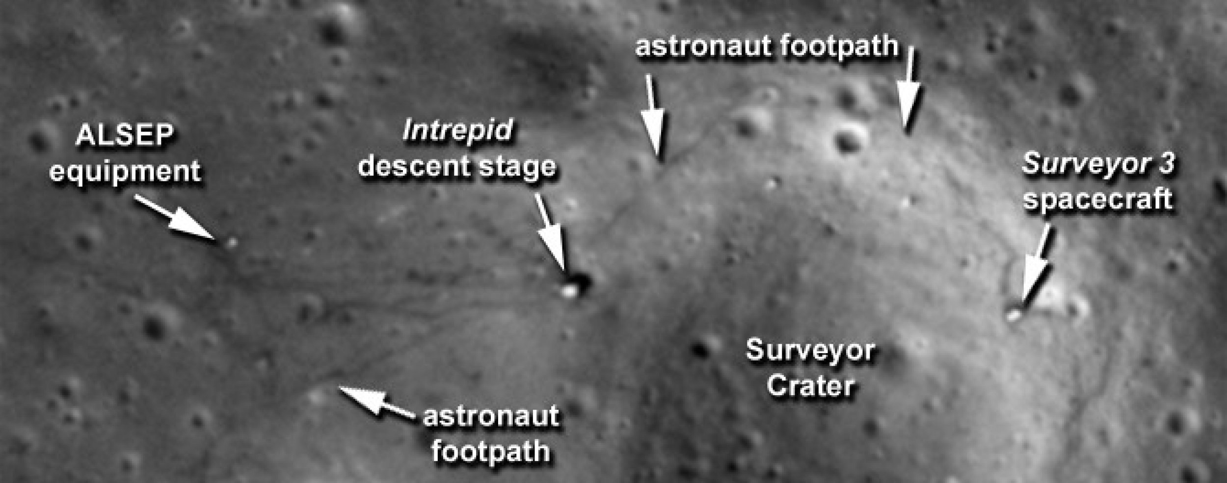
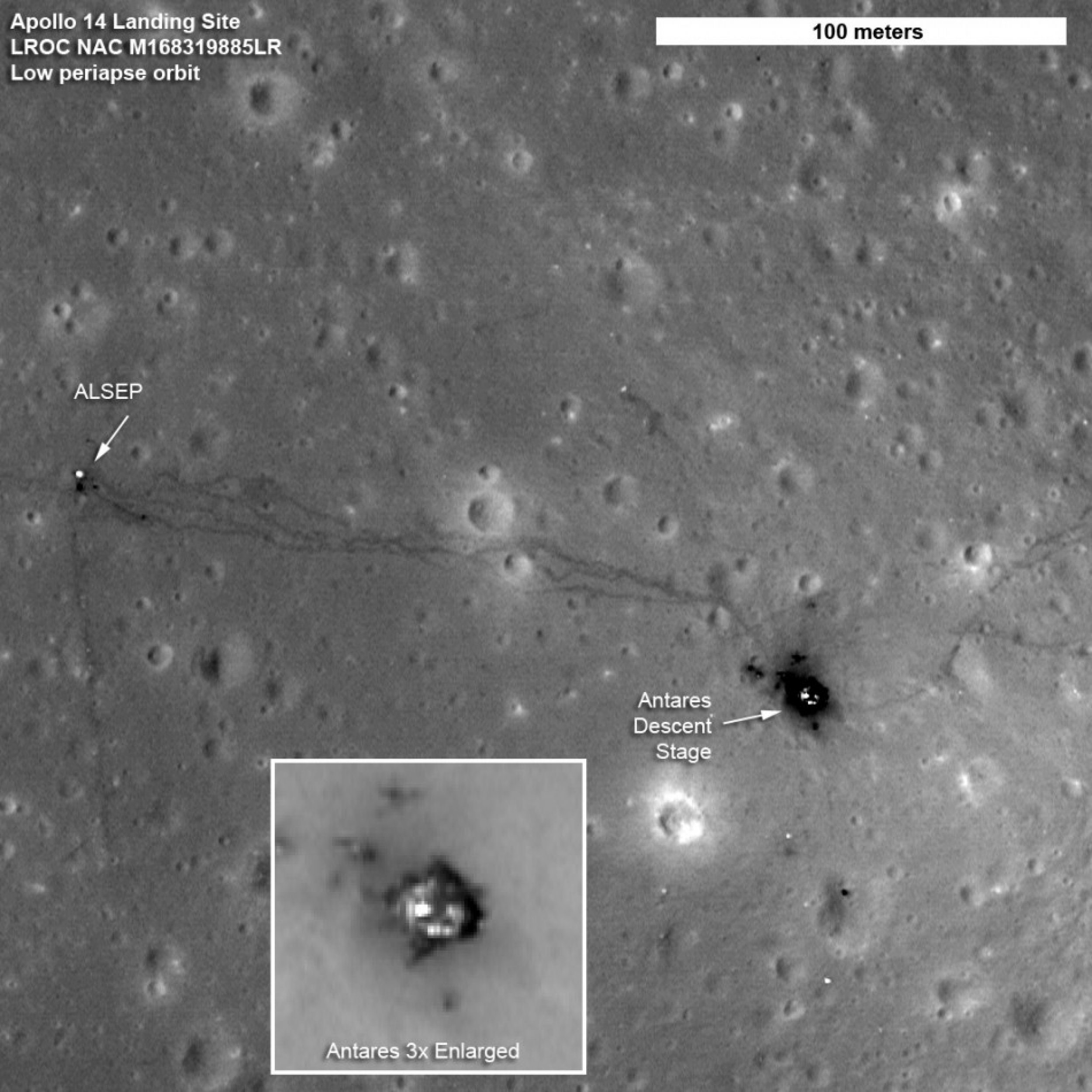
NASA's Lunar Reconnaissance Orbiter has captured the sharpest images ever taken from space of the Apollo 12, 14 and 17 landing sites. Images show the twists and turns of the paths made when the astronauts explored the lunar surface.
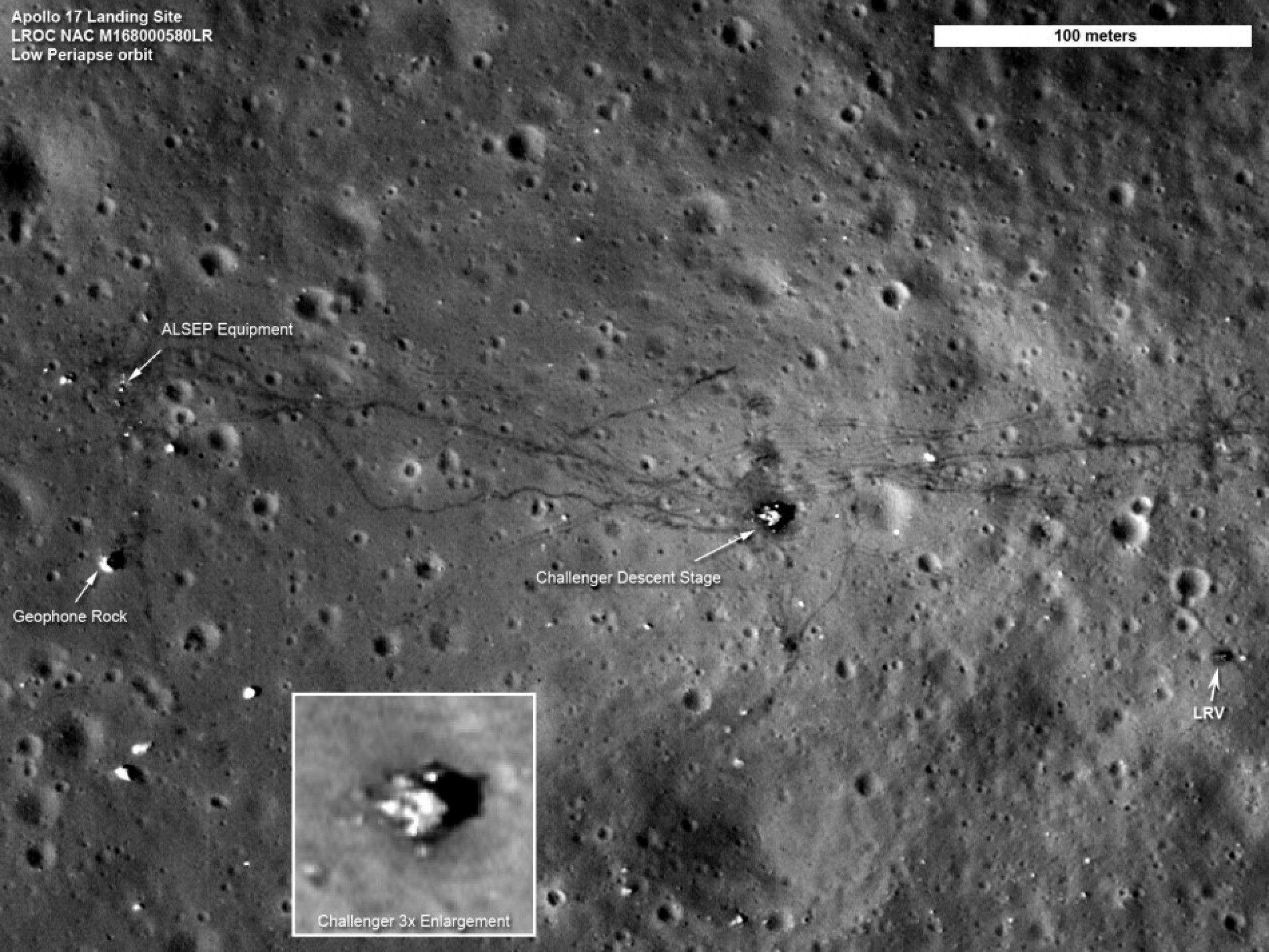
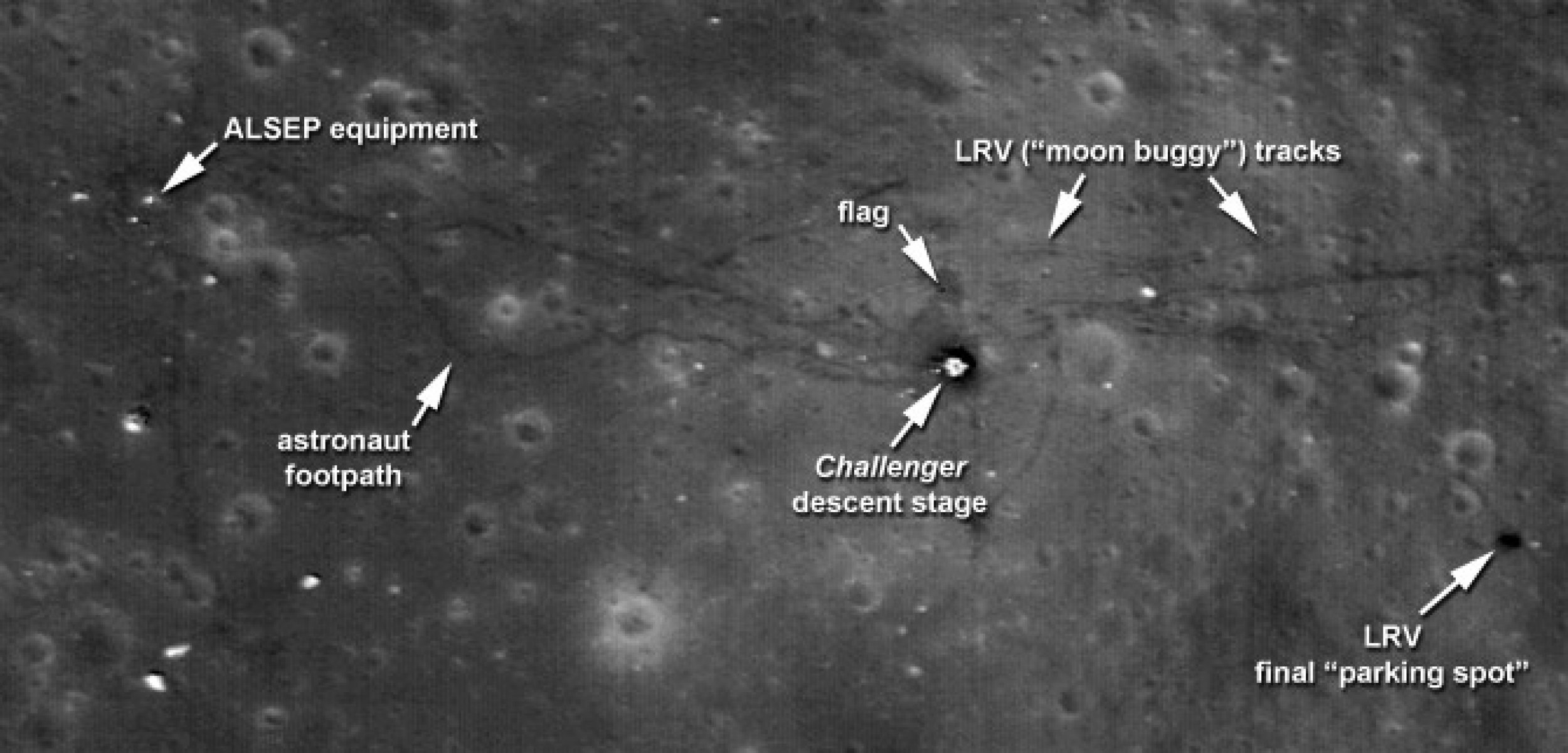
At the Apollo 17 site, the tracks laid down by the lunar rover are clearly visible, along with the last foot trails left on the moon. The images also show where the astronauts placed some of the scientific instruments that provided the first insight into the moon's environment and interior.
We can retrace the astronauts' steps with greater clarity to see where they took lunar samples, said Noah Petro, a lunar geologist at NASA's Goddard Space Flight Center in Greenbelt, Md., who is a member of the LRO project science team.
In the Apollo 17 image, the foot trails, including the last path made on the moon by humans, are easily distinguished from the dual tracks left by the lunar rover, which remains parked east of the lander.
One of the details that shows up is a bright L-shape in the Apollo 12 image. It marks the locations of cables running from the Apollo Lunar Surface Experiments Package's central station to two of its instruments.
The higher resolution of these images is possible because of adjustments made to LRO's orbit, which is slightly oval-shaped or elliptical. Without changing the average altitude, we made the orbit more elliptical, so the lowest part of the orbit is on the sunlit side of the moon, said Goddard's John Keller, deputy LRO project scientist. This put LRO in a perfect position to take these new pictures of the surface.
These images remind us of our fantastic Apollo history and beckon us to continue to move forward in exploration of our solar system, said Jim Green, director of the Planetary Science Division at NASA Headquarters in Washington.
VIDEO:
© Copyright IBTimes 2024. All rights reserved.


