

Skirball Fire Map: Wildfire Near 405 Freeway Prompts Evacuations In Bel Air

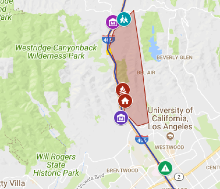
A wildfire broke out along the 405 Freeway in Los Angeles Wednesday, prompting mandatory evacuations of nearby homes. The fast-moving Skirball Fire closed the freeway in both directions and neared the Getty Center. The below map, first published by the Los Angeles Daily News, shows the extent of the flames.
The fire was reported at around 4:50 a.m. local time. Some 125 firefighters and two helicopters worked to contain the flames, Los Angeles Fire Department spokeswoman Margaret Stewart said, according to KTLA-TV. Residents west of the fire were asked to be ready to leave, although the area was not yet under a mandatory evacuation order.
“We don’t have a good feel on which direction this fire is heading,” Stewart said.
At least 50 acres were consumed by the Skirball Fire so far, while 25 mph winds continued to spread the blaze.
“It’s been years since anything here has burned at all,” said Los Angeles Fire Department Capt. Cody Weireter, according to the Los Angeles Times. “You’ve got heavy, heavy brush. You’ve got the dryness – obviously, we haven’t had any rain at all. A lot of the fire is topography driven, which already becomes dangerous. The wind is going to increase that twofold.”
Thus far it remained unclear how many structures had been damaged by the flames, though television footage showed homes in flames, according to the LA Times. No injuries had yet been reported. UCLA told faculty and students living off campus to stay home Wednesday.
“Except for UCLA Health, all other staff, faculty and students who are off campus should not attempt to come to campus until the situation is resolved,” the school said. “Classes are optional and students should check with their instructors.”
The J. Paul Getty Museum said it was monitoring the situation and would continue to issue updates throughout the day. All primary school classes were closed in the area.
“We’re still trying to get our arms around it,” said Weireter. “We’re still trying to get resources on scene and still trying to get our hose line in place and get our box around this.”
In other parts of Southern California the Thomas Fire and the Creek Fire continued to rage. Near Sylmar and Kagel Canyon, the Creek Fire had burned more than 11,000 acres as of Wednesday morning, destroying an estimated 30 homes. The Thomas Fire, in Ventura County, spread to over 50,000 acres. The fires spread in part due to what officials called the strongest Santa Ana winds of the season. Authorities said for at least some of the fires, the situation would likely continue into the coming days.
“This has only just begun,” said Los Angeles Fire Chief Ralph Terrazas.
Driving to LAX just as they’re closing the 405 for this roaring hillside fire near the Getty exit. Car windows are hot. Stay safe, LA. pic.twitter.com/gclO6A6WB9
— Rebecca Keegan (@ThatRebecca) December 6, 2017
© Copyright IBTimes 2024. All rights reserved.
-

Eiffel Tower Loses Sparkle For Parisians Ahead Of Olympics
-

Former Number One Momota Retires From International Badminton At 29
-

World Bank Aiming To Connect 250 Mn Africans To Energy Grid By 2030
-

IMF Says Global Debt Levels Face 'Great Election Year' Risk
-

Divisions Among Colombia's FARC Dissidents Complicate Peace Talks
-

French Far Right Gets Youthful Vibe With 28-year-old Leader
-

US Fed's Powell Says Inflation Fight May Take 'Longer Than Expected'
-

Mideast-related Oil Price Spike Threatens 'Relatively Good' Economic Outlook: IMF Chief Economist
-

Wine Growers 'On Tip Of Africa' Race To Adapt To Climate Change
-

Despite Olympic Truce, Games Wrestle With Political Fallout


