

Staten Island, Post-Sandy: How To Cope With The Next Big Storm?
Staten Island is sometimes called the “forgotten borough” of New York City, but since Hurricane Sandy devastated the area, it’s been receiving a lot more attention of late.
On Friday, the City University of New York’s College of Staten Island hosted a discussion on Sandy’s impact, and experts offered strategies for rebuilding in order to withstand both the next hurricane season and the ones to come.
Staten Island lies at an especially vulnerable place in New York harbor. The coastlines of Long Island and New Jersey meet at a near-perfect right angle that funnels storm surges right up to the island’s doorsteps.
“We’re in the bull’s-eye,” CSI geologist Alan Benimoff said Friday.
Most of the hardest-hit areas on Staten Island lie to the southeast, on a vast flat plain that was largely uninhabited marshes and swamps at the turn of the 20th century.
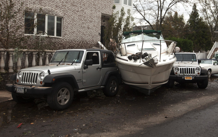
After Sandy hit, Benimoff went out on the streets of Staten Island and observed where the tide of debris stopped, then used that data to calculate how high a storm surge had swept in with the superstorm. The 14-foot storm surge, which was bigger than any hurricane that passed by the island over the past century, overwhelmed creeks and sewers, pushed houses aside, and left at least 19 people dead.
In southeastern Staten Island, the storm surge extended beyond the borders of Zone A, the areas of New York City that are subject to mandatory evacuations when any hurricane makes landfall. Both Benimoff’s data and newly updated preliminary maps from the Federal Emergency Management Authority make the case for updating the city’s flood zone maps, which are based on data from 1983.
New York City Mayor Michael Bloomberg already moved to heed the new data from Sandy. In January, he signed an emergency executive order suspending certain zoning restrictions and building codes so property owners rebuilding after Sandy could meet new flood standards.
When trying to formulate plans for dealing with flooding and rising sea levels, many officials and residents have looked across the Atlantic to the Netherlands. Seventeen million Dutchmen and Dutchwomen live in a country about the size of New Jersey, with many of the most populated areas lying below sea level.
At the CSI Sandy forum on Friday, Arjun Braanskamp, the economic officer for the Counsulate General of the Netherlands in New York, outlined the holistic approach that the Dutch have adopted for when the water comes knocking.
The Dutch have made sure to rely on multiple lines of defense -- not just a single dike, but dikes with marshes, wetlands, dunes and reefs before and behind. Walkways in certain parts of cities are allowed to flood and retain water until the tide subsides. The Dutch are also trying to work more in concert with natural forces, which is thought to be better for the environment and cheaper. For instance, to rebuild the sandy coastline near the Hague, the Dutch dumped a large amount of sand in a certain area and are letting the wind and tide move it along the coast, instead of doing multiple dredging and shaping that would be more expensive and environmentally costly.
Urban planners in the Netherlands are also looking for ways to adapt to the rhythm of the waters. A new housing development contains areas that are left open and grassy, and periodically flood each day as the tide goes in and out. They’re also looking at shoring up coastlines with dikes that contain residential and retail elements inside, and with parking garages nearby that can be emptied of vehicles and allowed to flood to retain water.
“We spent a long time trying to keep the water out,” Braanskamp said. “Now we are looking for better ways to let the water in.”
But experts from both sides of the pond agreed that the Dutch model shouldn’t be seen as a rigid formula or even an outright blueprint for what Staten Island should adopt.
“Every area has its own specific challenges,” Braanskamp said.
Interim CSI president William Fritz outlined a five-point plan for protecting Staten Island from future storm surges. The most important step the borough can take is to protect the existing dunes, wetlands and marshes that will be an important buffer against future storms. The community should also look to rebuild those dunes that Sandy took a bite out of to shore up the coastal defenses even further, educate its residents on coping with hurricanes and look into engineering solutions that could mitigate and accomodate the wrath of future storms.
University of Pennsylvania landscape architect Ellen Nieses presented several projects from her students that propose ways to protect Staten Island. There are a huge range of options available, from a single storm barrier, to several, to a levee system where cars could run along the top. Those low-lying areas on the southeastern part of the island could be rebuilt as golf courses that would be allowed to flood when storm surges come.
One difficult step the city will face in the near future is determining which areas of Staten Island are so risky to residents that they would have to be reclaimed. New York Governor Andrew Cuomo has already floated the idea of buying up properties in low-lying areas of the Rockaways and Staten Island.
“There are some parcels that Mother Nature owns,” Gov. Cuomo said in his State of the State speech in January. “She may only visit once every few years, but she owns the parcel and when she comes to visit, she visits.”
And since Staten Island can expect more visits from Mother Nature quite soon, the conversation about this borough’s future has a particular kind of urgency. As Benimoff noted, the next hurricane season starts on June 1.
“The clock is ticking,” he said.
© Copyright IBTimes 2024. All rights reserved.
-

IMF Says Global Debt Levels Face 'Great Election Year' Risk
-

Divisions Among Colombia's FARC Dissidents Complicate Peace Talks
-

French Far Right Gets Youthful Vibe With 28-year-old Leader
-

US Fed's Powell Says Inflation Fight May Take 'Longer Than Expected'
-

Mideast-related Oil Price Spike Threatens 'Relatively Good' Economic Outlook: IMF Chief Economist
-

Wine Growers 'On Tip Of Africa' Race To Adapt To Climate Change
-

Despite Olympic Truce, Games Wrestle With Political Fallout
-

What Will The Fed Do With The Latest Inflation Numbers?
-

US Retail Sales Up More Than Expected In March
-

Alexandre De Moraes: Brazil Judge In Feud With Elon Musk


