

Strong Magnitude-5.9 Earthquake Strikes China’s Gansu Province Monday, Killing 11 And Injuring 81: Reports

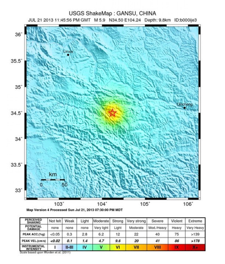
A strong magnitude-5.9 earthquake struck China’s Gansu province Monday at 7:45 a.m. local time (Sunday at 7:45 p.m. EDT), according to the U.S. Geological Survey. Initial estimates indicated the quake killed 11 people and injured another 81, Reuters reported, citing official state media.
The epicenter of the temblor was 6.1 miles deep and located about 8 miles east of Chabu, 94 miles west of Beidao and 766 miles west-southwest of Beijing, the USGS reported.
The China Earthquake Administration has initiated an emergency-response plan that includes the close monitoring of the tremor and its aftershocks, as well as the dispatching of disaster-relief teams to the affected areas in Minxian and Zhangxian counties, the official Xinhua News Agency said.
© Copyright IBTimes 2024. All rights reserved.
-

French Air Traffic Controller Strike Threatens Flight Chaos
-

Azerbaijan Says 'Closer Than Ever' To Armenia Peace Deal Amid Border Talks
-

How UK's Biggest Water Supplier Sank Into Crisis
-

Taiwan Hit By Dozens Of Strong Aftershocks From Deadly Quake
-

Gaza Health System 'Completely Obliterated': UN Expert
-

In Ecuadoran Amazon, Butterflies Provide A Gauge Of Climate Change
-

50 Years On, Vintage Vehicles To Reenact Portugal's Carnation Revolution
-

Conflicts Push Military Spending To 'All-time High': Report
-

'Thank You, America:' Zelensky And Netanyahu Applaud House Passage Of Foreign Aid Package
-

Women Journalists Bear The Brunt Of Cyberbullying


