

Tropical Storm Man-yi Cancels Flights Out Of Tokyo, Threatens Fukushima Nuclear Plant

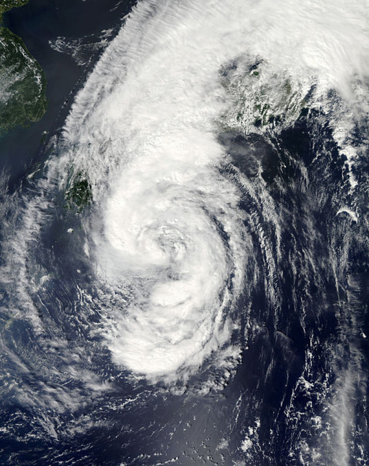
Tropical Storm Man-yi edged up the Pacific Coast of southern Japan Sunday night packing heavy rains and powerful winds as it headed north toward Tokyo and, even more worrying, the crippled Fukushima Daiichi nuclear power plant.
According to the latest forecast by the Japan Meteorological Agency, Man-yi is expected to hit somewhere between Osaka and Tokyo midday Monday, bringing a total of about 6 to 12 inches of rain. The season’s 18th storm could trigger dangerous flash flooding, with localized rain totals in excess of 12 inches in the mountains and coastal regions of southern Japan.
Officials warned of damaging wind gusts as high as 80 mph along Man-yi’s path, which could potentially cause widespread tree damage, power outages and some structural failures. Moreover, high surf is expected to pound the entire Pacific Coast of the country through early Tuesday as the storm transitions into a nontropical system.
At least 200 domestic flights and a handful of international flights scheduled for Monday, a public holiday, were canceled as a precautionary measure. Most were on journeys into and out of Osaka and the capital region. Transit officials also reduced train service nationwide as a result of the tropical storm.
The Japan Meteorological Agency issued an emergency weather warning Sunday that covers the entirety of the archipelago. At the heart of the red warning zone was the Fukushima area, which was badly damaged by the March 2011 earthquake and tsunami.
Some fear Man-yi could inundate the very place where utility crews are struggling to contain a leak of highly radioactive water from flowing under the Fukushima nuclear plant and into the Pacific Ocean. Already, it has been estimated that some 300 tons of toxic water enters the ocean each day.
© Copyright IBTimes 2024. All rights reserved.
-

Eiffel Tower Loses Sparkle For Parisians Ahead Of Olympics
-

Former Number One Momota Retires From International Badminton At 29
-

World Bank Aiming To Connect 250 Mn Africans To Energy Grid By 2030
-

IMF Says Global Debt Levels Face 'Great Election Year' Risk
-

Divisions Among Colombia's FARC Dissidents Complicate Peace Talks
-

French Far Right Gets Youthful Vibe With 28-year-old Leader
-

US Fed's Powell Says Inflation Fight May Take 'Longer Than Expected'
-

Mideast-related Oil Price Spike Threatens 'Relatively Good' Economic Outlook: IMF Chief Economist
-

Wine Growers 'On Tip Of Africa' Race To Adapt To Climate Change
-

Despite Olympic Truce, Games Wrestle With Political Fallout


