Tropical Storm Ophelia Reforms in the Atlantic (PROJECTED PATH & MAPS)
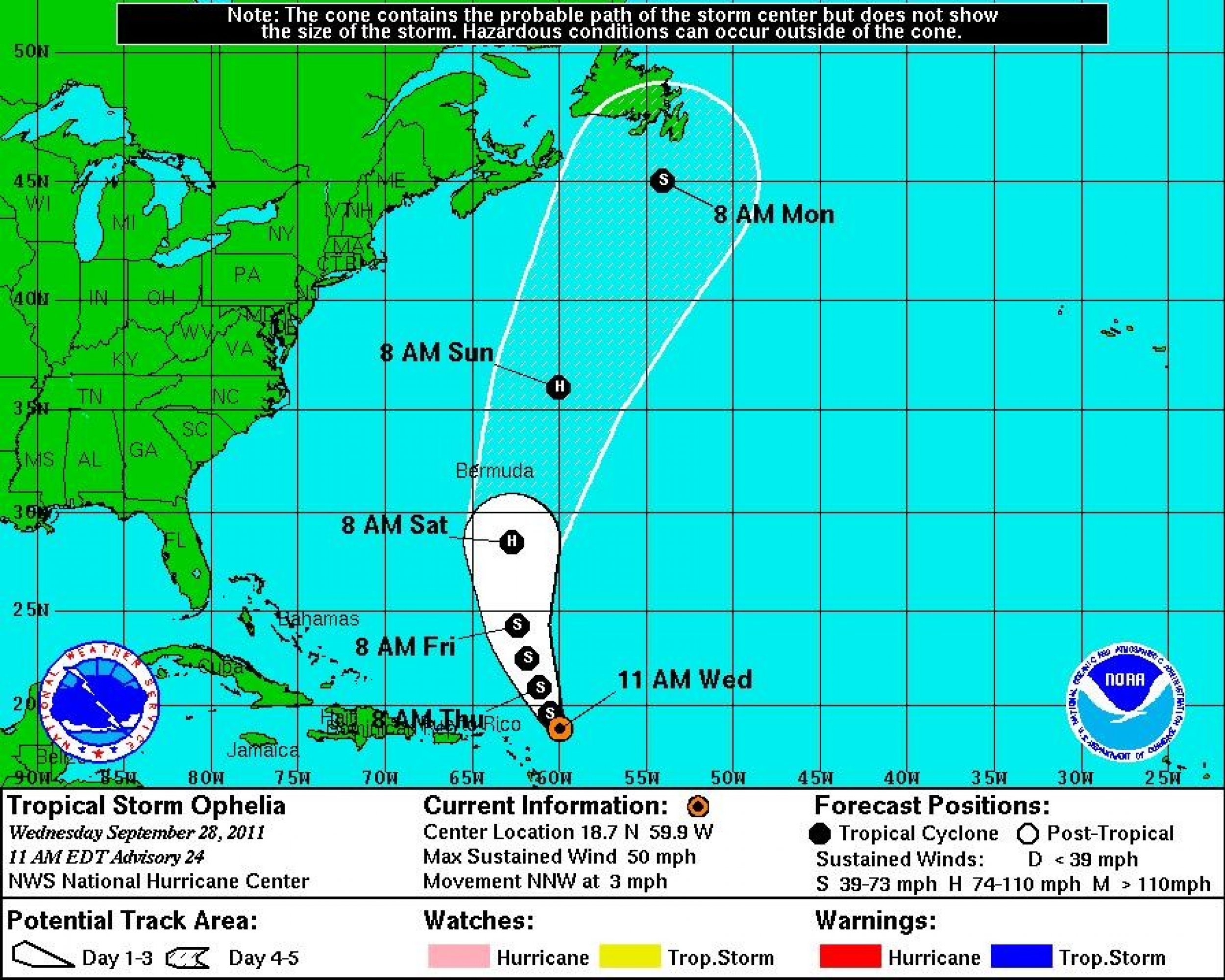
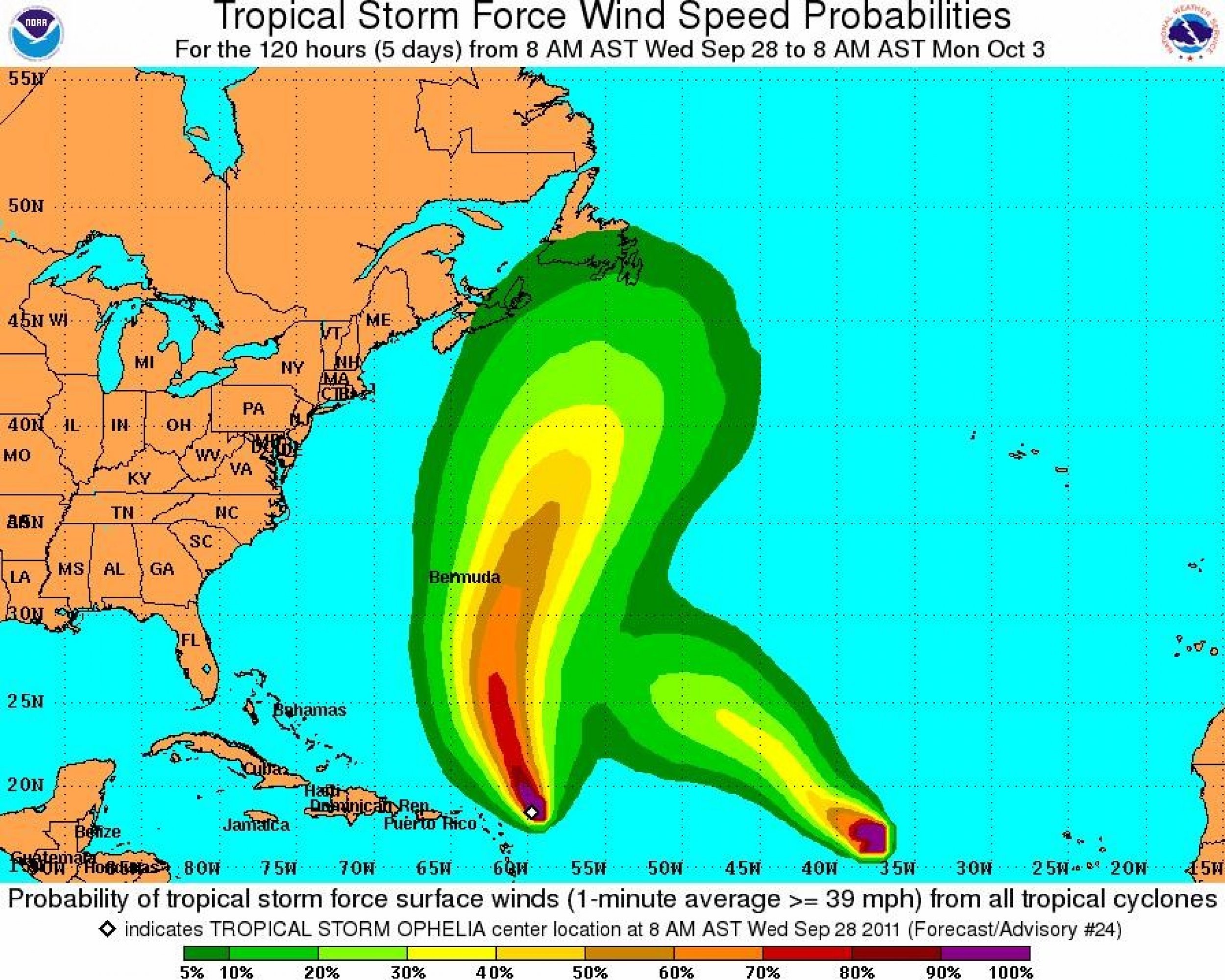
Ophelia is once again a tropical storm and churning away in the tropical Atlantic. While the storm is expected to become a hurricane by Saturday, its projected path should take it away from the U.S. mainland.
Tropical Storm Ophelia reformed Wednesday morning with maximum sustained winds of 50mph with higher gusts.
According to the 11 a.m. EDT alert from the National Hurricane Center in Miami, the storm is located about 215 miles east of the Northern Leeward Islands and moving north-northwest at just 3mph. On its projected path, Ophelia should continue moving north-northwest over the next 48 hours with an increase in forward speed.
Tropical-storm-force winds extend outward up to 85 miles, mainly to the east of the storm center.
At this time, there are no coastal watches or warnings and if Ophelia continues on its current path, the storm should stay well clear of any land.
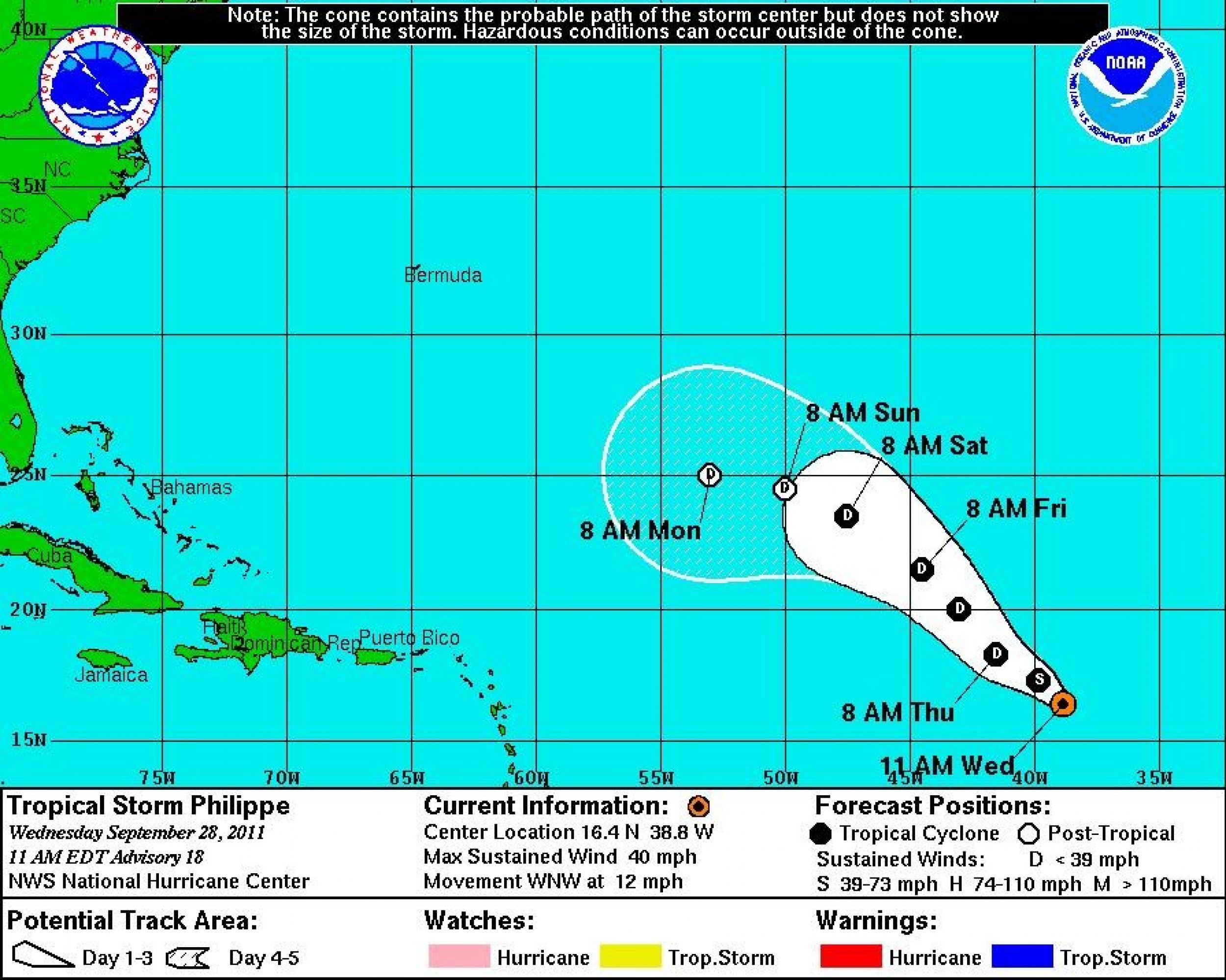
Elsewhere in the Atlantic, Tropical Storm Philippe has changed its course slightly. According to the 11 a.m. EDT alert from the National Hurricane Center in Miami, the storm is located about 980 miles west of the Cape Verde Islands with maximum sustained winds of 40 mph. Philippe is moving west-northwest at 285 degrees at 12mph and that general direction is expected to continue over the next 48 hours.
Conditions are unfavorable for any strengthening and Philippe is expected to weaken into a tropical depression by Thursday night.
Philippe is the 16th named storm of the 2011 Atlantic hurricane season. With over two months left and 16 named storms already, it's turning out to be the atypically busy year that forecasters had predicted
According to Michael Brennan, Senior Hurricane Specialist at the National Hurricane Center in Miami, the two storms in the Atlantic may be some of the last spawned by waves off the African coastline this year.
In October, the focus shifts into the Caribbean and the Gulf (of Mexico) where systems can form that can threaten Florida, Brennan said. We are certainly not out of the woods yet.


© Copyright IBTimes 2024. All rights reserved.


