Tropical Storm Philippe Projected Path and Maps
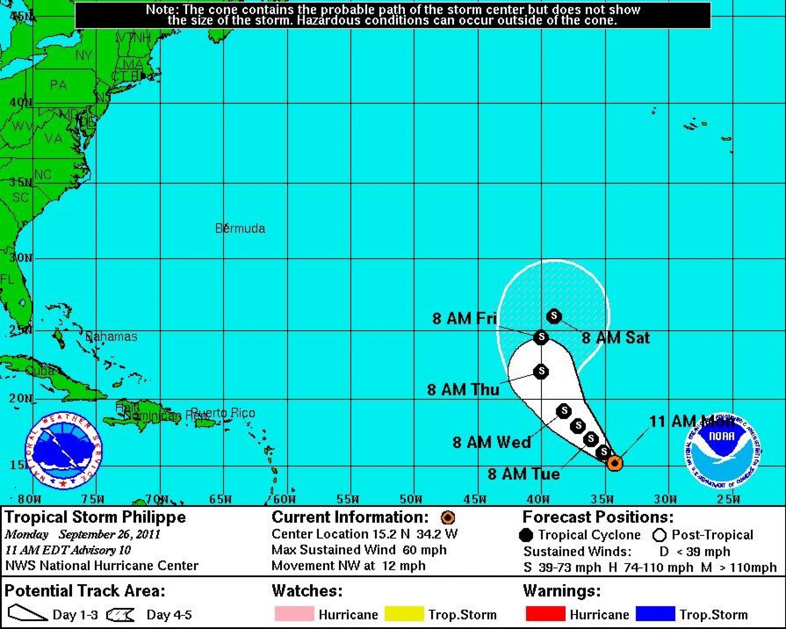
Tropical Storm Philippe is churning away far in the tropical Atlantic, but has changed little in strength.
Forecasters at the National Hurricane Center (NHC) in Miami have followed the weather system since Friday morning when it emerged as a broad low pressure system about 400 miles south-southeast of the Cape Verde Islands.
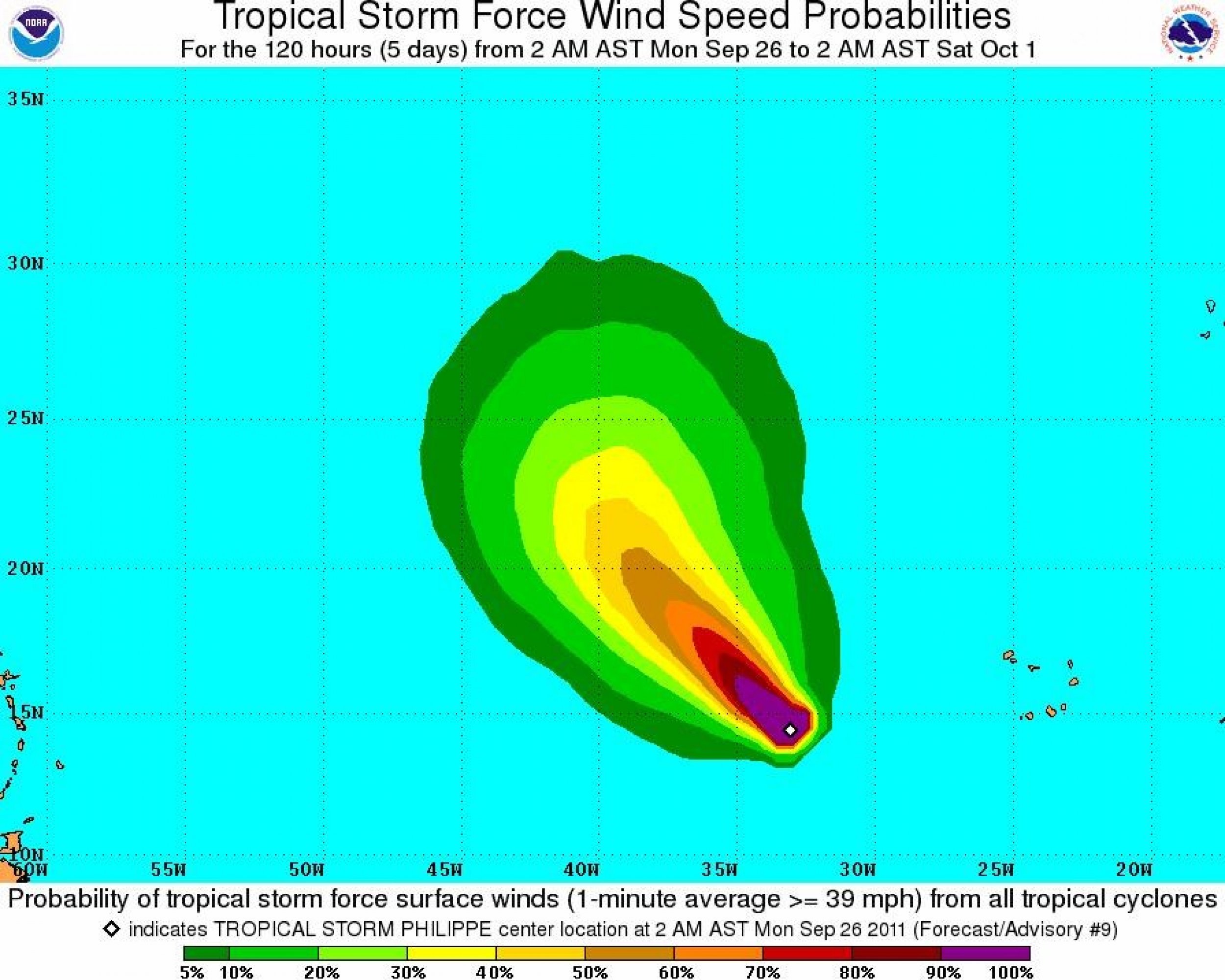
The system organized rather quickly over the weekend and by Monday morning, Philippe was packing maximum sustained winds of 60 mph with tropical-storm-force winds extending outward up to 70 miles from the storm center.
According to Monday's 11 a.m. EDT alert from the National Hurricane Center, Philippe is moving northwest at 12 mph. If it follows its projected path, the storm will pose no threat to land.
While the storm is projected to strengthen slightly during the next 24 hours, Philippe will likely remain a tropical storm through Saturday as it curves back east in the central Atlantic.
There are no coastal watches or warnings in effect.
Elsewhere in the Atlantic, the remnants of Tropical Storm Ophelia are moving west-northwest at 5 to 10 mph toward the Leeward Islands. The large area of disorganized showers and thunderstorms has a low chance of redeveloping into a tropical cyclone due to strong upper-level winds.
Philippe is the 16th named storm of the 2011 Atlantic hurricane season. With over two months left and 16 named storms already, it's turning out to be the atypically busy year that forecasters had predicted


© Copyright IBTimes 2024. All rights reserved.


