

East Coast Earthquake Upstages Hurricane Irene
A 5.9-magnitude earthquake centered in Virginia shook up the East Coast, with the tremors rippling from North Carolina all the way up to Toronto.
The U.S. Geological Survey said the earthquake -- which occurred at 1:53 p.m. EDT -- was half a mile deep and centered near Louisa County, Va., about 40 miles northwest of Richmond. Several buildings, including the White House and Pentagon, were evacuated. There were no immediate reports of injuries.
The last time the metro D.C. area had an earthquake of similar magnitude (4.8) was in 1875. Each year, there are smaller earthquakes that aren't felt, the U.S. Geological Survey said.
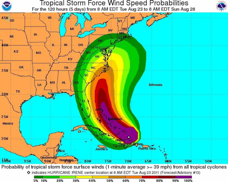
The earthquake comes as Hurricane Irene threatens to make landfall later this week along the East Coast. Irene would be the first hurricane to hit land in the U.S. since 2008.
While the future path of Irene is uncertain, it's important that those along the East Coast take steps to get prepared and stay informed as Irene approaches, FEMA said in a blog.
© Copyright IBTimes 2025. All rights reserved.
- MOST POPULAR IN Society


