

Guatemala’s Fuego Volcano Erupts, Spews Ash 4 Miles High

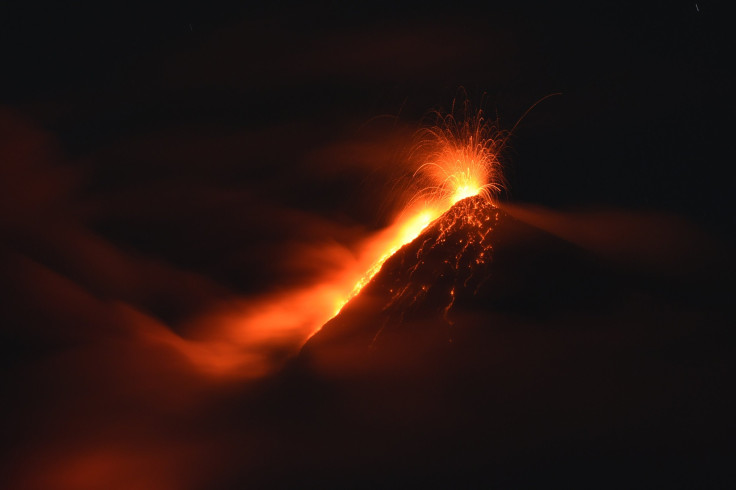
Guatemala’s Fuego volcano, near the colonial city of Antigua, erupted and shot ash about 4 miles high, according to reports Monday. No evacuations were ordered in the region.
The Fuego volcano, which translates to the volcano of fire, has been erupting occasionally throughout 2015 and has been active for at least a month. The country's volcanology agency said the mountain produced "constant sounds similar to a train locomotive and strong explosions" that shook roofs and windows up to 18 miles away, the Associated Press reported. National disaster response spokesman David de Leon said Monday that particulate matter from the volcano’s ash settled on at least eight nearby towns, according to AP.
Guatemala’s Volcanological Institute cautioned aviation authorities to make sure flights did not come into contact with the ash, local news outlet the Tico Times reported. The volcano is located about 31 miles southwest of capital Guatemala City and stands about 12,300 feet above sea level in south-central Guatemala.
In February 2015, Fuego experienced a powerful eruption that led to the closure of the capital’s airport. About 100 residents were reportedly evacuated following the eruption. In September 2012, the lava and ash from the volcano triggered evacuations of thousands of people in five communities.
© Copyright IBTimes 2024. All rights reserved.
- MOST POPULAR IN World


