Hurricane Irene 2011: Storm Strenthening; Taking Aim at New York, Northeast Corridor

Hurricane Irene is taking shape as a historic storm, strengthening and taking aim at the Northeast. Forecasters are calling Irene an extreme threat with the potential to be a serious multi-hazard threat for the major metropolitan areas of the Northeast along the I-95 corridor including New York City.
Major cities likely impacted with hurricane force winds, torrential rains, flooding, downed trees and power lines and widespread power outages include Philadelphia, New York, Hartford and Boston. Along the immediate coastlines, threats include storm surge, high winds, high waves and beach erosion.
Hurricane Irene is a major Category 3 storm with maximum sustained winds of 120 miles per hour Thursday, and the storm was located 735 miles south of Cape Hatteras, moving northwest at 12 miles per hour. The National Hurricane Center has issued a hurricane watch for northeastern North Carolina early Thursday morning as Irene churns up the coast toward North Carolina's Outer Banks.
Many residents and tourists of the Outer Banks are evacuating.
There's going to be flooding, there's going to be heavy rain, said National Weather Service Meteorologist Mike Rusnak, in the Virginia Pilot. It's just a matter of the exact track because it's still two days out and it's still too early to try to figure out out what kind of numbers to give here.
Irene is threatening to become the first major hurricane to hit the U.S. East Coast since Wilma struck Florida in 2005. Hurricane Ike was the last storm to make U.S. landfall, in 2008.
The storm could strengthen Thursday to a Category 4, with 135 mile-per-hour winds, the National Hurricane Center said.
Weather Channel experts on Thursday morning called Irene's threat to North Carolina coastal areas and the high-population northeast corridor an extreme threat and that the situation is particularly threatening and it is best for people to be on alert.
Computer models have sharpened over the last 24 hours and the latest forecasts early Thursday show rare storm potency for portions of the Northeast. Irene is expected to approach the Carolinas late Friday night through Saturday, with Northeast U.S. impacts continuing into the weekend and early Monday of next week.
Models show high probability that Irene will reach the New York area, possibly making a direct hit, as hurricane strength, with winds in excess of 70 miles per hour. The storm is likely to hit New York's metro area by late Sunday night.
The governors of New York and Connecticut ordered agencies to make ready for the storm. In Rhode Island, officials plan to activate a 24-hour operations center, said Denis Riel, a spokesman for the Emergency Management Agency.
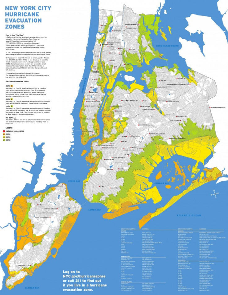
Also, in New York City Mayor Michael Bloomberg met with officials Wednesday plotting out emergency response strategy. He warned residents to be on alert, closely heeding cautionary advice if given.
Hurricane Bill was the last hurricane to strike the tri-state New York area back in 2009 and only minor damage was reported.
Nassau County Executive Ed Mangano on Wednesday warned residents to be prepared.
This is a good time to get prepared again in your homes, he said. There's items that you should stock up on, those that need to move or possibly be evacuated, perhaps seniors should think about having their medications refilled and having enough on hand.
© Copyright IBTimes 2025. All rights reserved.


