

NASA Radar May Predict Sinkholes By Detecting ‘Precursory Clues’ Of Underground Movement

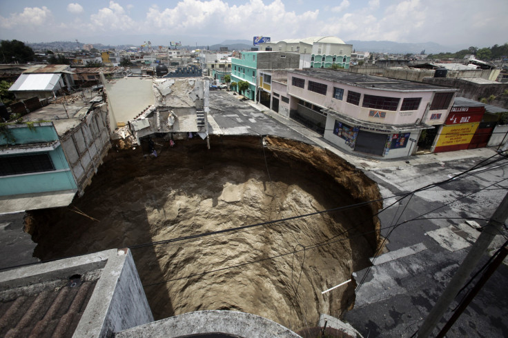
When the earth below Bayou Corne, La., collapsed on Aug. 3, 2012, it created a hole nearly 750 feet deep and covered nearly 15 acres. The sinkhole caused a flurry of bad publicity for Texas Brine Co., whose operations in Bayou Corne caused the underground salt dome cavern to collapse and resulted in a class-action lawsuit for the hundreds of nearby residents who were evacuated. Now, evidence suggests that NASA radar may have inadvertently spotted the sinkhole before it occurred.
Researchers from NASA’s Jet Propulsion Laboratory in Pasadena, Calif., analyzed data acquired by the agency’s Uninhabited Airborne Vehicle Synthetic Aperture Radar, or UAVSAR, system in 2012. UAVSAR uses radio waves to gather information about features on Earth’s surface. Researchers looked specifically at the ground where the giant Bayou Corne sinkhole formed and examined radar scans from a month and a year before the ground collapsed.
Their study, published in the journal Geology, found that over that time, the ground surface layer had moved as much as 10 inches toward the sinkhole’s center.
"Our work shows radar remote sensing could offer a monitoring technique for identifying at least some sinkholes before their surface collapse, and could be of particular use to the petroleum industry for monitoring operations in salt domes," Ron Blom, a NASA analysts and co-author of the study, said in a statement. "Salt domes are dome-shaped structures in sedimentary rocks that form where large masses of salt are forced upward. By measuring strain on Earth's surface, this capability can reduce risks and provide quantitative information that can be used to predict a sinkhole's size and growth rate."
Last month, a sinkhole with the diameter of a school bus swallowed several very valuable corvettes in Bowling Green, Ky. And, in November, a large sinkhole opened up in a Chicago South Side neighborhood and threatened to take a nearby home. Might NASA’s radar technology have detected them, too?
"Every year, unexpected ground motions from sinkholes, landslides and levee failures cost millions of dollars and many lives," Cathleen Jones, who also worked on the study, said in a statement. "When there is small movement prior to a catastrophic collapse, such subtle precursory clues can be detected."
While it might work in theory, even the scientists who worked on the study say the likelihood of spotting a future sinkhole is still hit or miss.
"You could spend a lot of time flying and processing data without capturing a sinkhole," Blom said. "Our discovery at Bayou Corne was really serendipitous.”
Not to mention that the cost of running UAVSAR is extremely high.
"Since I work for an aircraft radar it's kind of expensive and time consuming to deploy," Jones told Design and Trend. "So it's better to use satellites for that kind of study where you're doing more than a pilot study. And there are satellites that can be used at this time and also the U.S. plans to launch a satellite in the future."
© Copyright IBTimes 2024. All rights reserved.
- MOST POPULAR IN Science


