

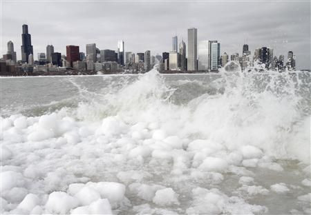
Snow Storm ‘Saturn’ Update: 10 Inches of Snow Predicted For Chicago

A snowstorm warning has been issued for the Chicago area on Tuesday.
Weather forecasters are predicting up to 10 inches of snowfall and, according to recent news reports, freezing rain, sleet and light snow are expected to hit the area Monday night and then turn into snow once temperatures drop early Tuesday morning.
The storm is supposed to continue into the evening, with 1 to 2 inches of snow per hour being dumped on the area at its height. There is a “fair amount of uncertainty” on when the storm will peak, the National Weather Service said.
The city is expected to get 5 inches of snow total, and the suburbs should see around 10 inches. Wind gusts of 30 mph winds will likely create snowdrifts, the Chicago Sun-Times said.
“The worst conditions we’re expecting [are] during the day on Tuesday,” National Weather Service meteorologist Ben Deubelbeiss explained.
Snowstorm Saturn, as the Weather Channel is calling it, has the potential to be the largest to hit the area this winter, exceeding the 5.4 inches of snowfall at O’Hare International Airport last week, the weather service said. That same storm dropped 12.1 inches in suburban Antioch, Ill.
The winter storm warning will begin for the Chicago area at 3 Tuesday morning and last until later that evening, the National Weather Service forecast. Winter storm warnings mean dangerous travel conditions and significant snow.
People who are trying to come home during rush hour will be greatly affected, the weather service said. Those who must travel at that time are being urged to pack a flashlight and extra food and water in case they get stranded.
Chicago isn’t the only place that has to worry about snowstorm Saturn. According to the National Weather Service it will start in the Northern Plains and sweep across the Upper Mississippi Valley, Geart Lakes and Ohio Valley. Southeastern Minnesota, eastern Iowa, western/far southern Wisconsin, northern Illinois and northern Indiana are expected to be hardest hit.
But don’t expect to see snow on the ground for long. The weather is expected to warm up by the end of the week according to forecasters, reaching highs of 44 degrees on Saturday.
© Copyright IBTimes 2026. All rights reserved.
- MOST POPULAR IN Culture


