US Drone Track: Interactive Map Facilitates Real-Time Monitoring
Tracking the drones in the U.S. airspace has become much easier thanks to the interactive map constructed by the Electronic Frontier Federation (EFF) which uses the data obtained from the Freedom of Information Act Lawsuit against the Federal Aviation Administration (FAA).
The map reveals a clear picture of the rapid deployment of unmanned aerial drones by military, state and law enforcement agencies inside the domestic area.
A congressional mandate and Department of Homeland Security Initiative enabled facilitation and acceleration of adoption of drones by public and private entities in the U.S., The Verge has reported.
Local police in Texas and Florida have already spotted drones in several places, and new data reveals that sighting of police and military drones have become a regular occurrence. Many public and private entities are likely to join the fray.
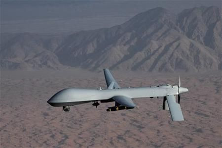
Drones are employed for a variety of purposes and come with varying payload of surveillance and data collection. The U.S. Air Force near Lincoln County employs the reaper drones with "Gorgon Stare" technology that come with a nine-camera array capable of monitoring an entire city.
Law enforcement authorities and police employ drones for drug investigations. Maryland Sheriff's Department is planning to use drones equipped with special imaging technology to track large patches of farmland for marijuana growth. Police in Arlington, Texas, employ drones to identify drug transactions with Leptron Avenger drone, which EFF notes is loaded with LIDAR technology to detect traffic violations, The Verge has indicated.
Among the more utilitarian aspects of the drone usage is the California Department of Forestry employing drones to fight the forest fires and University of Colorado applying for 200 drone licenses in 2008 to aid ad hoc wireless network acting as communication relay.
Besides, several state and local agencies are interested in new ways of engaging drones. The Washington State Department of Transportation has requested the drone license to facilitate avalanche control. The U.S. Department of Energy, Wyoming, sought drones to monitor fugitive methane emissions, the Electronic Frontier Foundation has stated.
The complete picture on the domestic drone usage is yet to emerge as EFF has received just about half of FAA's drone records.
However, the drone usage does not come incident-free. Several drones crash into civilian airports that serve over half-million passengers a year.
Problems cited for drone crashes include pilot error, mechanical failure and poor coordination with civilian air-traffic controllers, according to the Washington Post.
© Copyright IBTimes 2026. All rights reserved.
- MOST POPULAR IN Technology