

Earthquake-Triggered Landslides Could Soon Be Predicted With New Model
History is evidence that earthquakes can claim life and property on an unimaginable scale. Whether it is the United States, China, or any other part of the world, these ground-shaking events are known to cause a lot of damage, leaving thousands of people dead, injured, and homeless.
Several government agencies, including the U.S. Geological Survey, have been tracking these events on a regular basis and alerting the population living in the so-called danger zone. The effort helps in reducing the impact of a quake to some extent, but there is still no way to predict an impending tremor, which means people cannot be warned well in advance.
Several teams across the globe are working on tools that may foresee an earthquake sometime in the future, but recently, a team of researchers at Indiana University looked at another aspect of the case — landslides that those quakes can trigger.
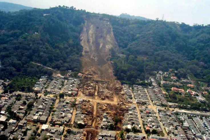
During an earthquake, the sudden, rapid movement of plate tectonics shakes up the soil covering it. In hilly regions, this could make the ground along the slopes unstable and cause catastrophic landslides. For instance, the Great Sichuan earthquake that occurred in 2008 triggered landslides that alone killed nearly 20,000 people — an estimated 30 percent of the total number of deaths in the incident.
This is why the group developed a mathematical model that uses a range of factors to predict which region could witness landslides following an earthquake. The estimate, provided in a matter of minutes, could be used by people in the affected zones and first-responders for saving thousands of lives anywhere in the world.
"Earthquakes can be devastating, horrific and stressful events," Anna Nowicki Jessee, who developed the model, said in a statement. "The ultimate goal of this work is that fast, regional estimates of landslide occurrence would provide a way for those who are affected to receive the aid they need more quickly and efficiently."
In the wake of an earthquake, the newly-developed model will use five main factors to determine where a landslide could occur. This includes the magnitude of the tremor, the steepness of the ground, how wet the ground is, and the type of rock affected and land cover in that region. The team developed and tested several variants of the model on past earthquake-triggered landslides and chose the one that delivered the most accurate predictions.
This means as soon as an earthquake occurs, scientists could use the ground-shaking information related to that quake and produce a map showing which regions in the affected zone could witness landslides within minutes.
As the model could play a critical role in relief work, it will be included into the U.S. Geological Survey's Ground Failure tool, which will be a part of the agency’s earthquake reporting system.
The study titled, “A Global Empirical Model for Near Real ‐ time Assessment of Seismically Induced Landslides, ” was published July 23 in the Journal of Geophysical Research: Earth Surface.
© Copyright IBTimes 2025. All rights reserved.
- MOST POPULAR IN Science


