

NASA Satellite Captures Image Of Arizona Bush Fire From Space

KEY POINTS
- Arizona's Bush Fire started June 13 and has affected over 60,000 acres since
- Many residents have been orderd to evacuate from their homes
- Satellite image of the fire shows burn scars and signs of still-active fires
- Arizona also has other bush fires currently burning
- The Bush Fire is the largest in the state of Arizona this year
The Bush Fire affecting Arizona has burned over 60,000 acres of land, making it the largest in the state this year. An image of the fire from space shows the burn scars and active fires in the affected area.
On June 13, a vehicle fire near Bush Highway and State Route 87 caused a fire in nearby tall grass and brush. Soon, thousands of acres of land was affected by the fires and hundreds of homes were evacuated.
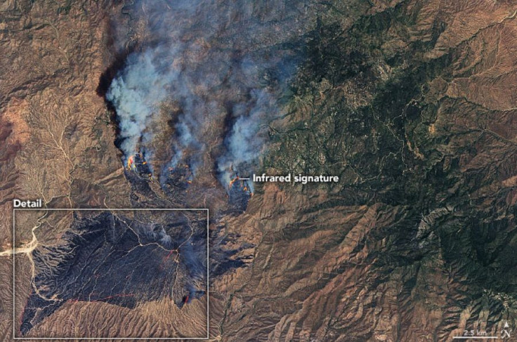
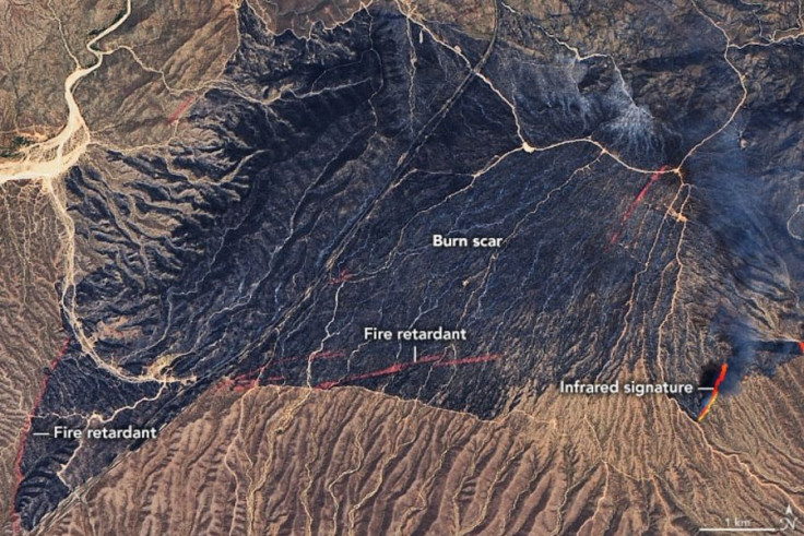
An image taken by the Operational Land Imager on NASA and the United States Geological Service's Landsat 8 satellite on June 14 shows the extent of the damage the Bush Fire has caused. By combining natural-color images and the thermal infrared signature, the image was able to capture the actual burn scars in the area as well as the parts of the land where the fire still burns under thick smoke.
In a more detailed view of the lower left area of the image, one can see the dark burn scars as well as the streaks of red that are actually marks of the fire retardant that was deployed by air to stop the fires from spreading further. Infrared signatures in the lower right side of the image also show parts of the land that are still actively burning.
As of June 16, nearly 65,000 acres northeast of Phoenix, Arizona, had burned, making the Bush Fire the largest in the state this year and the largest in the United States right now. Hot and dry conditions in the area are fueling the fire, helping it to grow quickly and making it more difficult to contain.
According to AZCentral, authorities are also working to contain other bush fires in the state: The Mangum Fire, which has burned nearly 30,000 acres in the Kaibab National Forest; The Bighorn Fire, which was started by a lightning strike; and the Bringham Fire, which has burned over 14,000 acres.
According to NASA Earth Observatory, which shared the satellite image of the Bush Fire as its Image of the Day, fire season usually peaks in the Southwest U.S. in June and July. The National Interagency Fire Center has predicted this season to have "above normal significant fire potential," particularly in Arizona.
As of Tuesday, the Bush Fire is on the verge of becoming one of the top 10 largest wildfires in state history.
© Copyright IBTimes 2025. All rights reserved.
- MOST POPULAR IN Science


