

Oregon Tree Rings Show Evidence Of Historic 1700 Quake, Tsunami

KEY POINTS
- Researchers looked into Oregon's Douglas fir trees for evidence of the 1700 tsunami
- They found that the trees in the tsunami zone had reduced growth rates that year
- Researchers suspect that the shaking and the seawater contributed to this effect
The earthquake that took place along the west coast of North America on Jan. 26, 1700, is said to be the largest one known to occur in the "lower 48" U.S. In their study, a team of researchers found evidence of this "megathrust" in old trees in Oregon.
The January 1700 earthquake that happened in the Cascadia Subduction Zone was a big one. At magnitude 9.0, it did not only cause destruction and landslides in several areas but also triggered a tsunami that crossed the Pacific and caused damage to the Pacific coast of Japan.
There has been evidence of this historic event in the trees in Washington, Oregon State University (OSU) said in a news release, so a team of researchers sought to determine whether they could also see indications of it in the trees in Oregon.
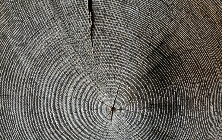
For the study, recently published in the journal Natural Hazards and Earth System Sciences, the researchers obtained core samples of 38 Douglas fir stands that predate the 1700 earthquake in Mike Miller Park in South Beach. In fact, the majority of the trees date back to 1670 while one even dates back to 1650, one of the study's authors, Robert Dziak of the National Oceanic and Atmospheric Administration Pacific Marine Environmental Laboratory, said as per OSU.
Based on "new and updated" models, the area would have been inundated by up to 10 meters of water during the tsunami event. When researchers compared the growth rate of the samples to those taken from Douglas firs that are not in the tsunami inundation zone, they found that the trees in the tsunami inundation zone actually had "significantly reduced" growth rates in 1700.
"To better detect tree growth anomalies near 1700 CE, we also compared the South Beach Douglas-fir tree-ring data to two other Douglas-fir datasets from the Oregon Coast Range and western Cascade Mountains which would have experienced similar climate conditions but not tsunami inundation," the researchers wrote. "When compared to these control sites, South Beach tree growth is significantly lower in 1700 CE, which reaffirms that the South Beach Douglas-fir growth is unusually low for the region."
"The tsunami appears to be the event that most affected the trees' growth that year," Dziak said in the OSU news release.
As for what may have caused the growth reduction, the researchers surmised that the shaking of the ground, as well as the seawater, may have contributed to this effect. As Dziak explained, while seawater typically drains quite quickly, there is a pond in the area where the seawater likely settled.
Only recently, NASA scientists also found that such inundation of seawater from the storm surge caused by Hurricane Irma in 2017 may have been the "nail in the coffin" for some areas of the mangrove forests in southwestern Florida.
For their next move, the researchers are to conduct an "isotopic analysis" of the wood from 1700, OSU noted. They are also looking into similar signatures from trees affected by the 2011 Japan tsunami.
"If successful, we could develop a powerful new technique to map prehistoric tsunami run-up along the Pacific Northwest coast," study co-author, Bryan Black of the University of Arizona, Tucson's Laboratory of Tree-Ring Research, said as per the OSU news release.
© Copyright IBTimes 2025. All rights reserved.
- MOST POPULAR IN Science


