

Typhoon Maysak Loses Strength As It Heads Toward Philippines
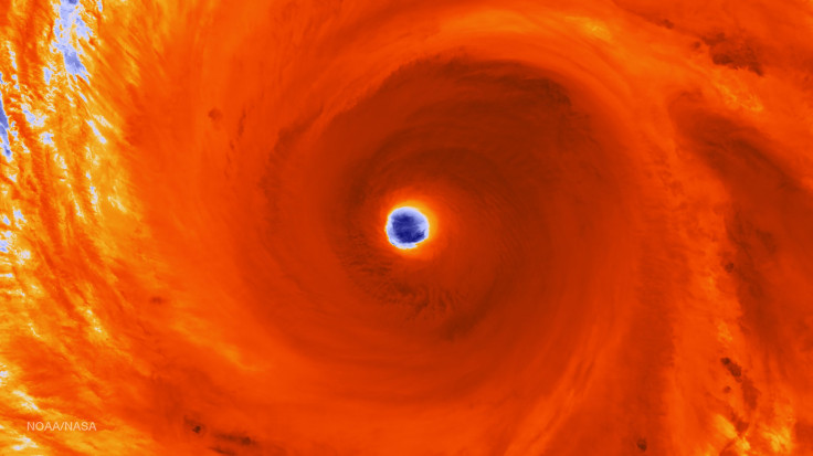
Typhoon Maysak has slightly weakened as it heads toward the Philippines, and it is expected to make landfall late Saturday or early Sunday, authorities reportedly said Thursday. Earlier, astronauts aboard the International Space Station released photos of the typhoon as it moved across the northwest Pacific.
Early on Thursday, Esperanza Cayanan, an officer of the government's weather bureau, said Typhoon Maysak was 569 miles northeast of eastern Borongan city and was moving northwest at 12 mph. The typhoon is reportedly expected to make landfall in the central or northern part of the Philippine island of Luzon, and several parts of the country are expected to receive heavy rains and strong winds, CNN reported.
Authorities reportedly said that the Category 5 typhoon, which has so far claimed the lives of at least nine people in the Federated States of Micronesia, has weakened. On Thursday, the winds had died down to about 132 mph from 150 mph. However, the typhoon is still being categorized as a Category 4, according to media reports.
"This will not be a catastrophic storm," meteorologist Ivan Cabrera told CNN, adding that Maysak is expected to become a tropical storm by the time it hits the Philippines. However, it could still cause flooding and bring strong winds in the region.
The Philippines is frequently hit by typhoons. In December 2014, at least 21 people were killed when Typhoon Hagupit made its first landfall in Eastern Samar. However, Hagupit was reportedly less powerful than Typhoon Haiyan, which left over 7,300 people dead when it hit the region in November 2013.
A closer look... #Maysak pic.twitter.com/yyB1509oTr
— Sam Cristoforetti (@AstroSamantha) March 31, 2015© Copyright IBTimes 2026. All rights reserved.
- MOST POPULAR IN Science


