Arctic Outbreak Next Week Will Be Coldest Air Of The Season
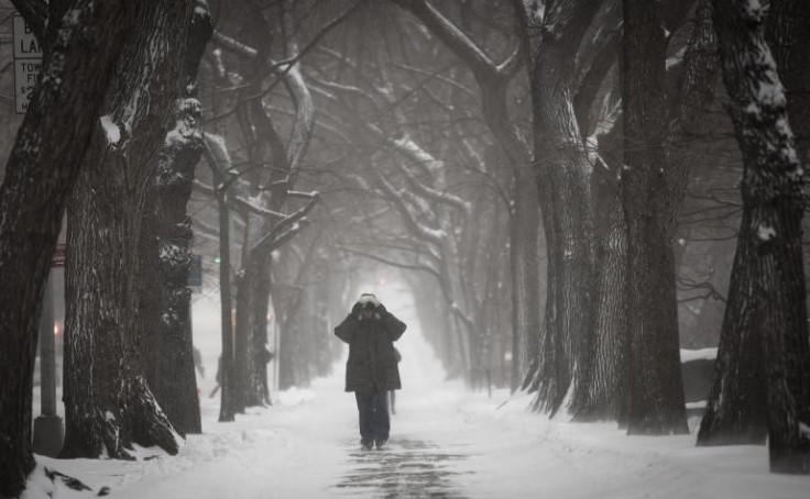
It’s not December, but it sure feels like it and national forecasters said it’s about to get worse. An “arctic surface high” will bring the coldest air of the season next week, with potential for below-freezing temperatures and snowfall, weather reports predicted.
During the weekend, a cold snap will move across much of the eastern United States, delivering much colder weather and winter-like conditions. The coldest weather of the season is expected to arrive by early next week for the northern Plains and Montana, with temperatures from a high near 60 degrees Sunday to a high in the 20s Monday. As a massive arctic front moves southward, highs 10- to 35 degrees below average will plunge into the Plains, western Great Lakes, and the upper and mid-Mississippi Valleys Monday and Tuesday, the National Weather Service predicted.
Significant snowfall is also expected for parts of the northern Rockies and northern Plains where winter storm watches and winter weather advisories are already in effect. This cold front could last longer and be more widespread than other cold surges we have seen so far, weather forecasts indicated.
Weather forecasts suggest light to moderate rain and/or snowfall is increasingly likely downwind of the Great Lakes and across Minnesota and Wisconsin through the rest of this weekend. Though, this should be a relatively minor event in terms of snowfall accumulations. Periods of rain and occasional thunderstorms will fall across the Florida peninsula through Sunday afternoon, according to the latest reports.
The major pattern change predicted next week has many on Twitter speculating whether it’s evidence of a second polar vortex in the works, even though federal forecasters have already said it’s “unlikely.”
Are you ready for next week's #PolarVortex? It's coming. http://t.co/jYESbRKguH pic.twitter.com/9j2FpsrQGu
- Anderson Cooper 360° (@AC360) November 8, 2014The Polar Vortex is coming to the US this week. Fox News will of course say that is happening because Obama hasn't stood up to cold fronts.
- Dean Obeidallah (@Deanofcomedy) November 8, 2014It's not even November, and some are already panicking about a "polar vortex" coming. Stop. Cold snaps are NORMAL this time of year. #rage
- Matt Rudkin WSBT (@MattRudkinWSBT) October 31, 2014© Copyright IBTimes 2026. All rights reserved.
- MOST POPULAR IN Science