

China Launches Satellite To Take High-Res Images Of Earth
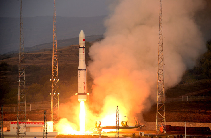
China launched a high-resolution imaging satellite on Wednesday, the country’s first low-orbit remote sensing satellite, Xinhua news agency reported. The synthetic aperture radar (SAR) satellite, called Gaofen-3, was launched from the Taiyuan Satellite Launch Center in northern Shanxi Province at 6:55 a.m. local time (6:55 p.m. EDT Tuesday).
The launch vehicle for Gaofen-3 was a Long March 4C rocket, and Wednesday’s launch was the 223rd mission by the Chinese-made Long March carrier rockets. The SAR satellite can capture images that are accurate down to one meter (about three feet) in distance and will operate as an all-weather 24-hour observation platform, according to Xinhua. It “will be used for disaster warning, weather forecasting, water resource assessments, and the protection of maritime rights.”
The indigenously-developed Gaofen-3 has 12 imagine modes and a lifespan of eight years. It will primarily be used by the State Oceanic Administration of China.
The Gaofen (the word means high resolution) project was started by China in 2013, and five satellites have already been launched under the program. Gaofen-4, launched late in 2015, was the first geosynchronous satellite launched by the Asian powerhouse.
The satellite and the Long March 4C rocket were developed by the China Academy of Space Technology and the Shanghai Academy of Spaceflight Technology.
© Copyright IBTimes 2025. All rights reserved.
- MOST POPULAR IN World


