

Hurricane Irene 2011 Threatens Bahamas, U.S.
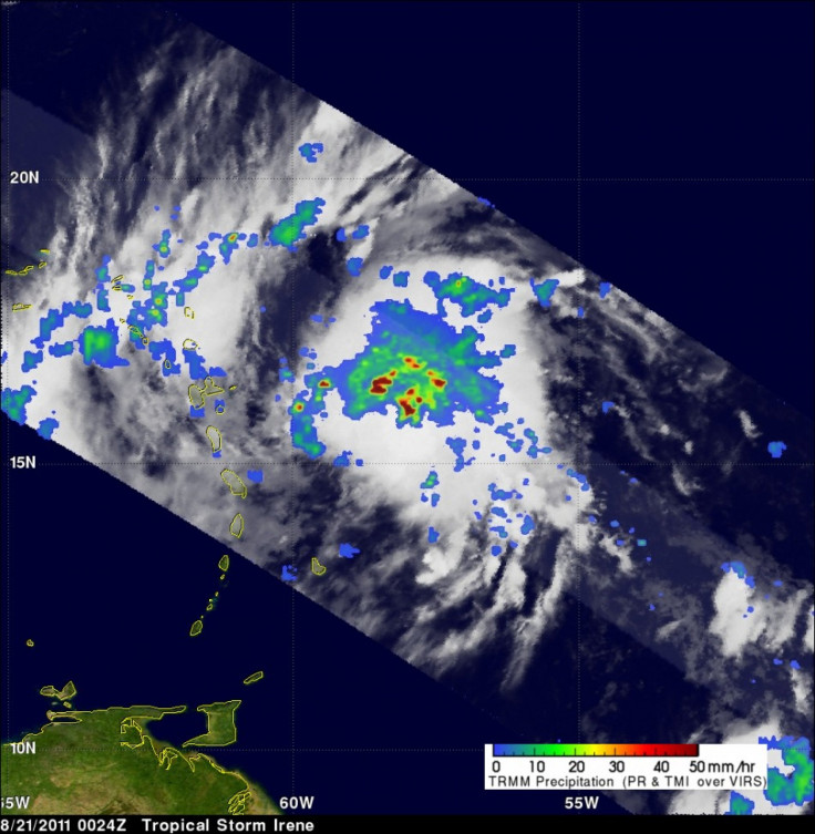
Hurricane Irene sustained 80 mph winds as the storm rocked the area just off the northeastern coast of Hispaniola. The National Hurricane Center expected Irene to continue gaining momentum over the next few days but by Thursday, forecasters said that it could be a major Category 3 hurricane with winds up to 115 mph.
The storm continues to threaten the Atlantic coast from South Florida to the Carolinas.
The most relentless rains and winds remained north of Hispaniola and the threat of deadly flooding has subsided. Despite this, Haiti warned its residents to prepare for evacuation.
The Dominican Republic opened a dam to relieve the Artibonite River, which has historically caused its banks to swell during past storms of this nature, Haitian radio reported.
In Puerto Rico, watches and warnings were retracted as Irene pulled away.
At 11 a.m. the National Hurricane Center said that Irene was stronger than expected.
The National Hurricane Center significantly raised expectations about Irene's rage, projecting that it will become a major Category 3 hurricane with 115 mph winds by Thursday when it approaches the Central Bahamas.
Forecasters have maintained that the entire state of Florida could be in danger and that residents should monitor Irene closely. The margin of error on long-term forecasts is 200 to 250 miles and a tremble may bring her to shore.
Many computer models has moved Irene's projected path eastwards over the last two days, suggesting that Irene could distress the coasts of George, South Carolina, and North Carolina.
© Copyright IBTimes 2024. All rights reserved.
-

Oil: 'Mother Of Corruption' In Venezuela
-

'Extreme' Climate Blamed For World's Worst Wine Harvest In 62 Years
-

Macron Warns 'Mortal' Europe Needs Credible Defence
-

Bitcoin And Crypto Price Review - Another Myth Gets Busted?
-

Mass Cancellations Loom Despite French Air Union Cancelling Strike
-

Mired In Crisis, Boeing Reports Another Loss
-

Recycled 'Zombie' Misinformation Targets US Voters
-

Hackers Leak Part Of Source Code Of El Salvador's Bitcoin Wallet
-

Azerbaijan Says 'Closer Than Ever' To Armenia Peace Deal Amid Border Talks
-

How UK's Biggest Water Supplier Sank Into Crisis


