

Irene Regains Strength to Category 2 Again
Hurricane Irene strengthened back into a Category 2 storm as it approached to the Bahamas early Wednesday, the U.S. National Hurricane Center said.
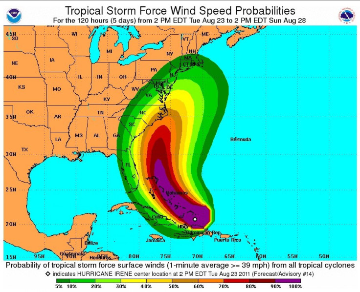
At 2 a.m., Irene had top winds of 100 miles per hour (155 km per hour) and was 400 miles southeast of Nassau. It was expected to strengthen further before approaching the North Carolina coast on the weekend, the forecasters said.
Irene is the first Atlantic hurricane to seriously threaten the U.S. in three years.
While Florida is almost out of the danger zone in terms of a direct hit, it's bad news for the mid-Atlantic states.
We've going to have a very large tropical cyclone move up the Northeastern seaboard in the next five to seven days so just about anybody that lives along the Northeast and Southeast coast of the mid-Atlantic needs to be aware of this and prepare for it,'' hurricane center director Bill Read said Tuesday evening.
Federal Emergency Management Agency Administrator Craig Fugate said the entire East Coast should be on alert.
The onset of adverse weather will hit the Carolinas by Saturday, the Miami Herald reported, with treacherous surf conditions starting on Friday.
It is projected to move into the mid-Atlantic states by Sunday and then into the Northeast by Monday, forecasters said.
The impact could be widespread, depending on exactly where the storm goes,'' Read said. We see no reason for it not to be a major hurricane in its track northward up along the gulfstream. We're very concerned about what's going to happen in New England.''
On Monday, Irene eased away from the northwestern Caribbean, leaving nearly 1 million people in the dark in Puerto Rico, a billionaire's mansion torched by lightning in the British Virgin Islands, and fears of flooding across Hispaniola.
Have a look at the maps below:
© Copyright IBTimes 2025. All rights reserved.
- MOST POPULAR IN Science


