

Katia Path: Storm Might Reach U.S. East Coast Next Week; Gulf Coast Braces for Another
Tropical Katia is not expected to strengthen much on Friday, as wind shear clips the system, but forecasters say the storm will likely regain hurricane strength and perhaps cut a path toward the U.S. East Coast by the middle of next week.
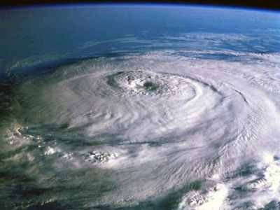
At 8 a.m. Friday, Katia was in the Atlantic, 700 miles east of the Leeward Islands. The storm is moving northwest at 15 miles per hour with sustained winds of 70 miles per hour, just below hurricane strength.
If current forecast path models are right, Katia will be roughly 1,000 miles east of Miami by Tuesday, the day after Labor Day, and the storm could take a track toward North Florida, Georgia, and the Carolinas.
Once Katia is free of wind shear, forecasters say the storm could intensify over the weekend into a Category 3 storm, with winds of 115 miles per hour or higher, as it nears the U.S.
Katia is the second hurricane of the 2011 Atlantic season, after Hurricane Irene, and though models are uncertain after early next week some examples do show the storm could make U.S. landfall.
But there is another developing story on Friday involving Atlantic storms, as Tropical Depression 13 threatens the U.S. Gulf Coast, including New Orleans, hit hard by flooding from Katrina in 2005. Forecasters say the depression is likely to become Tropical Storm Lee, and could have significant impact into the Labor Day weekend and early next week that residents along the coasts of Alabama, Mississippi, Louisiana and even Texas should closely monitor through the weekend.
Forecasters say the storm has the potential to drench the low-lying region with up to 20 inches of rainfall before it ends. In Louisiana, Gov. Jindal said he is concerned about the serious threat of flash flooding from the storm in his state and he declared a state of emergency late Thursday as the system continued to develop.
The tropical depression is likely to become Tropical Storm Lee, the 12th named storm of the Atlantic hurricane season. Last week, Irene became the first hurricane to strike the U.S. since Ike in 2008.
Tropical storm warnings have been posted from Mississippi to Texas, including New Orleans, where current forecast models show the biggest threat and potential impact. The National Hurricane Center said the system will pour massive amounts of rain over southern areas of the coast.
Already Friday, New Orleans is facing locally heavy rainfall possible from the storm. The forecast calls for a 70 percent chance of precipitation Friday and Saturday, with easterly winds gusting from 20 to 35 miles per hour.
Tropical Depression 13, likely to become Tropical Storm Lee, has a slow northwest movement forecast through Friday, followed by a turn toward the north on Friday night and Saturday. The center of the cyclone is expected to approach south Louisiana during the weekend. Gradual strengthening is forecast, and the depression could become a tropical storm on Friday.
Forecasters say isolated amounts of rainfall of 20 inches are possible, with widespread accumulations of 10 to 15 inches. Also, storm surge water levels could rise by as much as two to four feet above ground level of onshore flow.
New Orleans was severely damaged by inland flooding from Hurricane Katrina after water from torrential rainfall breached levees. Inland flooding is often the most damaging aspect of tropical storms and hurricanes that strike the U.S., not wind.
Tropical Depression 13 poses a high threat level to the U.S. Gulf Coast region, including potential flooding risks in New Orleans which was devastated by high waters from Hurricane Katrina in 2005. Louisiana Gov. Bobby Jindal has issued a state of emergency in advance of the storm, likely to intensify to tropical storm status with drenching rainfall.
But as for Katia, the storm will be monitored closely over the next days as forecasters sharpen its likely projected path, which increasingly points to possible U.S. landfall.
Energy companies with oil and gas interests in the Gulf of Mexico were keeping watch on the developing thunderstorms mass emerging in the northwest Caribbean Sea and eastern Gulf. BP Plc became the first major oil producer on Wednesday to say it was evacuating more than 500 non-essential workers from platforms in the Southern Green Canyon area.
London-based BP said it is preparing for a potential shut down in the Gulf region if necessary should the storm escalate.
Katia became the 11th named storm of the Atlantic hurricane season which runs from June 1 to Nov. 30. Irene became the first to reach hurricane strength, before ravaging a path up the East Coast last week.
Hurricane forecasters have been following Katia since Saturday when it emerged then-unnamed as a large area of showers and thunderstorms off the west coast of Africa. The storm became better organized on Sunday and Monday, when it became a tropical depression.
Katia's storm name replaces Katrina in the rotating storm roster because of the catastrophic damage from the 2005 storm which ravaged the U.S. Gulf Coast, causing catastrophic flooding in New Orleans and virtually destroying the Mississippi coastline.
© Copyright IBTimes 2025. All rights reserved.
- MOST READ


