

Sierra Nevada Grew An Inch During California Drought: NASA Study
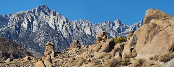
Earth’s topography morphs constantly. Water flow carved out vast valleys into rocks, tectonic plates shifted over time causing massive uprisings of the crust we now call mountains and mountain ranges. These mountains are seen as constants in any landscape they are a part of. They are viewed as immovable topographical features that remain unchanged through time. However, new research shows that California's Sierra Nevada mountain range actually grew in height during the drought years from October 2011 to October 2015.
According to a new NASA study, loss of water from the rocks of California's Sierra Nevada caused the mountains to grow nearly an inch in height during the four-year period, although, the study also found that after the period of drought, two years of abundant snow and rainfall seen in the region helped the mountains regain about half as much water in the rocks as they had lost in the preceding drought, and thereby falling about half an inch in height again.
"This suggests that the solid Earth has a greater capacity to store water than previously thought," said research scientist Donald Argus of NASA's Jet Propulsion Laboratory in Pasadena, California, who led the study, in a NASA press release.
Water from the rocks escaped through cracks and soil within fractured mountain rocks and during the drought there was no water to replenish the lost H2O. But, as the snow and rain gathered momentum, the process reversed.
The research team used data from 1,300 GPS stations in the mountains of California, Oregon and Washington, collected from 2006 to October 2017 to see the change over-time.
These GPS receivers were installed as part of the National Science Foundation's Plate Boundary Observatory to measure the motion of the tectonic plates that sleep below our feet. There are subtle movements in these plates that could give us several clues about possible future seismic activity and the presence of faults and cracks in the system. The receivers can monitor elevation changes within less than a tenth of an inch in an area they are trained at.
Water lost from within fractured mountain rock from 2011 to 2015 was calculated with this sophisticated data set and was found to be around 10.8 cubic miles of water. This is estimated to be 45 times as much water as Los Angeles currently uses in a year.
"One of the major unknowns in mountain hydrology is what happens below the soil. How much snowmelt percolates through fractured rock straight downward into the core of the mountain? This is one of the key topics that we addressed in our study," said NASA JPL water scientist, Jay Famiglietti, who collaborated on the research.
They credit the rise and fall in height to the effect of the extra weight. When the rocks are heavy with water, the whole mountain is pulled down because of gravity. And, when this water weight disappears the mountain lightens and rises again.
The team calculated the data while keeping in mind other factors such as tectonic plate movement and corrected the data to study height increase solely due to water loss from rocks.
"What does the water table look like within mountain ranges? Is there a significant amount of groundwater stored within mountains? We just don’t have answers yet, and this study identities a set of new tools to help us get them," Famiglietti added.
The study was published in the Journal of Geophysical Research: Solid Earth, on Nov. 24.
© Copyright IBTimes 2025. All rights reserved.
- MOST POPULAR IN World


