

Arctic Ice Cover Hits Second-Lowest Minimum In Recorded History

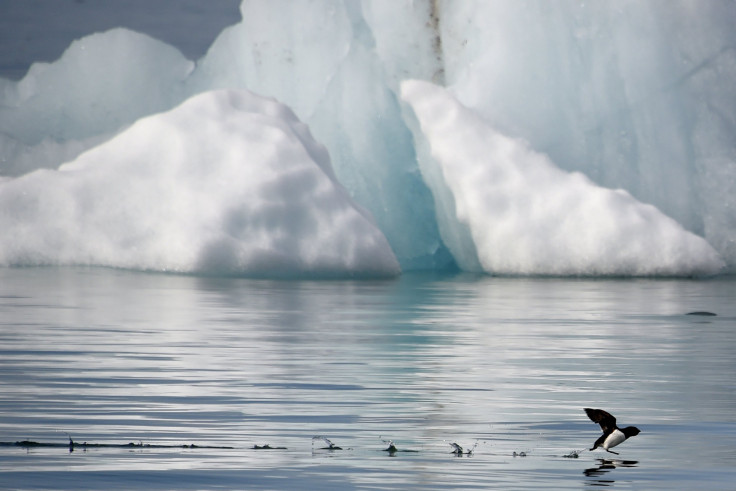
Scientists at the U.S. National Snow and Ice Data Center (NSIDC) announced Thursday that the Arctic ice cover in 2016 reached the second-lowest minimum ever recorded, effectively tying with the ice extent in 2007.
The NSIDC published an analysis of the ice cover using satellite data from NASA and concluded that it reached its minimum extent on Sept. 10, standing at 1.60 million square miles. The last time the minimum ice cover was at the same level was on Sept. 18, 2007. The Arctic sea ice declines to its annual minimum naturally in September.
“It was a stormy, cloudy, and fairly cool summer,” NSIDC director Mark Serreze said in a statement. “Historically, such weather conditions slow down the summer ice loss, but we still got down to essentially a tie for second lowest in the satellite record.”
The ice cover was at its recorded maximum low in March and rapidly declined in May. However, due to a cooler summer, more ice remains now than toward the end of 2012, according to NSIDC senior scientist Julienne Stroeve. Still, the September ice extent surprised scientists.
“It’s pretty remarkable that this year’s sea ice minimum extent ended up the second lowest, after how the melt progressed in June and July,” Walt Meier, a sea ice scientist with NASA’s Goddard Space Flight Center, said in a statement. “June and July are usually key months for melt because that’s when you have 24 hours a day of sunlight — and this year we lost melt momentum during those two months.”
The lowest minimum Arctic ice cover ever occurred in 2012 when the ice extent stood at 1.31 million square miles. Although the current minimum is better, it does not change the fact that the ice cover is rapidly shrinking. The Arctic ice cover in recent years has been below the 30-year average from 1981 to 2010.
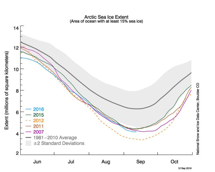
The average minimum extent of the Arctic ice cover between 1981 and 2010 stood at 2.40 square miles. In 2005, the minimum ice extent stood at 2.05 square miles. Scientists warned, however, that the ice extent figure for 2016 is preliminary and is subject to change.
© Copyright IBTimes 2025. All rights reserved.
- MOST POPULAR IN World


