

‘Dangerous’ Wind Chills In Northern Plains With Values 65 Degrees Below Zero Possible

KEY POINTS
- Blizzard conditions will be accompanied by "dangerous wind chills"
- Strong west winds with gusts of up to 65 miles per hour is possible in Wyoming
- In parts of Wyoming, wind chills as low as 65 degrees below zero are possible
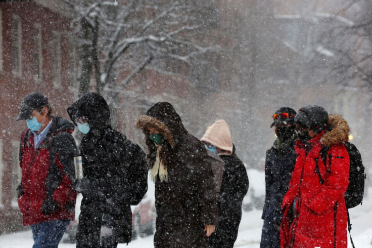
Weather forecasters are expecting "dangerous wind chills" in the Northern Plains within the next few days, as affected states brace for strong winter storms that bring heavy snow. Wind chill alerts have been issued in six states.
"Arctic air and dangerous wind chills to remain entrenched across the Northern Plains over the next several days," the National Weather Service (NWS) said in its Short Range Public Discussion report published Monday.
Wind chills with values between 35 to 55 degrees below zero are possible through the end of the week, the agency warned. Wind chill values near minus 25 degrees "mean that frostbite is possible within 15 minutes," the NWS stated.
The Weather Prediction Center (WPC) also warned of blizzard conditions across parts of the Northern Plains, Great Lakes and Upper Midwest starting Wednesday evening.
Low pressure developing along the Arctic cold front is expected to produce heavy snow and blizzard conditions for much of the north-central U.S. starting Wednesday night, potentially continuing into the Holiday Weekend. Here are key messages for the blizzard. pic.twitter.com/lupLQ2IXsH
— NWS Weather Prediction Center (@NWSWPC) December 19, 2022
The office further noted that blizzard conditions starting mid-week could lead to "dangerous to at times impossible" travel both through land and air.
"Dangerous wind chills will accompany the blizzard, creating a significant hazard for anyone that becomes stranded," the WPC said.
In Washington, the NWS in Seattle said the heaviest snow is expected Tuesday, adding that residents planning for travel should prepare for "winter driving conditions."
A winter storm will impact the area tonight and Tuesday, bringing widespread snow accumulation to both the lowlands and the mountain passes. Those planning to travel tomorrow need to be prepared for winter driving conditions. #wawx pic.twitter.com/XACVyjYwCS
— NWS Seattle (@NWSSeattle) December 19, 2022
In Idaho, officials at the NWS in Boise said light snow is expected Monday evening, but colder temperatures due to another round of snow are forecasted for Wednesday and Thursday.
❄🥶Light snow expected tonight, mainly over the central ID mountains and valleys. A cold front will bring another round of snow on Wednesday with colder temperatures on Thursday. Thursday will be 20-30 degrees below normal! #idwx #orwx pic.twitter.com/y0tttkIoCw
— NWS Boise (@NWSBoise) December 19, 2022
Over in Montana, officials are expecting widespread snow starting Tuesday evening through Wednesday evening, accompanied by "dangerously cold temperatures."
Winter storm warnings have been issued Tuesday PM through Wednesday PM across western Montana. An arctic front will bring widespread snow, areas of blowing snow, and dangerously cold temperatures. #mtwx #idwx pic.twitter.com/dZTNphxDvy
— NWS Missoula (@NWSMissoula) December 19, 2022
In Wyoming, the NWS in Cheyenne said west winds with gusts of up to 65 miles per hour are possible through Tuesday morning.
High Wind Warning and Wind Chill Advisory. #newx #wywx pic.twitter.com/0fmVb4TBpP
— NWS Cheyenne (@NWSCheyenne) December 20, 2022
For residents of South Dakota, the NWS in Sioux Falls noted that winds will start getting elevated Wednesday and could gain strength bringing wind gusts of more than 50 miles per hour by Thursday.
Winds become elevated on Wednesday with only marginal breezy conditions expected with gusts up to 10-20 mph.
— NWS Sioux Falls (@NWSSiouxFalls) December 19, 2022
Winds ramp up Thursday morning with gusts between 45-50+ mph likely. The strong winds persist through Friday afternoon before gradually waning through Saturday.
(3/4) pic.twitter.com/A5PrLJj56Z
In North Dakota, "impactful" weather isn't expected until Thursday, with wind chills and blowing snow forecasted to affect travel conditions.
Hate to sound like a Grinch, but impactful weather is expected within our area Thursday and Friday, including potential for blizzard conditions (20% chance).
— NWS Grand Forks (@NWSGrandForks) December 19, 2022
Monitor the forecast for updates, consider making alternate travel plans, and prepare for difficult travel. #ndwx #mnwx pic.twitter.com/gQaZBhePRB
Officials have also issued wind and winter storm advisories in the Northern Plains.
Winter Alerts in Washington
Wind Chill Advisory effective through 4 p.m. Tuesday:
- Okanogan Valley
- Waterville Plateau (wind chills as low as 30 below zero possible)
Winter Storm Warning effective through 7 p.m. Tuesday:
- Admiralty Inlet Area, Bellevue and Vicinity, East Puget Sound Lowlands, Bremerton and Vicinity, Eastern and Western Strait of Juan de Fuca, Seattle and Vicinity, North Coast, Hood Canal Area, Everett and Vicinity, Western Skagit County and Western Whatcom County
Winter Storm Warnings effective through 4 a.m. Wednesday:
- Central and Western Chelan County
- Wenatchee Area (wind chills as low as 45 below zero possible)
- Western Okanogan County (wind chills as low as 45 below zero possible)
Winter Storm Warning effective through 7 a.m. Wednesday:
- Washington Palouse (wind chills as low as 30 below zero possible)
Winter Storm Warning effective through noon Wednesday:
- Northeast Blue Mountains (wind gusts of up to 40 miles per hour possible)
Winter Alerts in Idaho
Wind Chill Watches effective through Thursday evening:
- Northern Panhandle (wind chills as low as 35 below zero possible)
- Coeur d'Alene Area (wind chills as low as 30 below zero possible)
- Idaho Palouse (wind chills as low as 30 below zero possible)
- Central Panhandle Mountains (wind chills as low as 35 below zero possible)
Winter Storm Warning effective through 10 a.m. Wednesday:
- Central Panhandle Mountains (wind chills as low as 35 below zero possible)
Winter Storm Warning effective through 5 p.m. Wednesday:
- Big Hole Mountains, Caribou Range and Bear River Range (wind gusts of up to 50 miles per hour possible Wednesday)
Winter Alerts in Montana
Wind Chill Advisory effective through noon Friday:
- Beartooth Foothills, Carter, Bighorn Canyon, Fallon, Custer, Judith Gap, Golden Valley, Melville Foothills, Livingston Area, Musselshell, Northern and Southern Big Horn, Northern and Southern Rosebud, Northern Stillwater, Northern Sweet Grass, Treasure, Southern Wheatland, Southwestern Yellowstone, Red Lodge Foothills, Northern Park and Powder River (wind chills as low as 45 below zero possible)
Wind Chill Warning effective through 6 p.m. Thursday:
- Helena Valley, Big Belt Mountains, Castle Mountains, Bridger Mountains, Upper Blackfoot and MacDonald Pass, Elkhorn and Boulder Mountains (wind chills as low as 60 below zero possible)
Wind Chill Warning effective through 11 a.m. Friday:
- Gates of the Mountains (wind chills as low as 60 below zero possible)
Winter Storm Warnings effective through 5 p.m. Wednesday:
- East Glacier Park Region and Southern Rocky Mountain Front
- Northern and Southern High Plains
Winter Alerts in Wyoming
High Wind Warning effective through 8 a.m. Tuesday:
- North Snowy Range Foothills (west winds with gusts of up to 65 miles per hour possible)
Wind Chill Advisories effective through 11 a.m. Friday:
- Central and East Laramie County, Goshen County, Converse County Lower Elevations and East Platte County (wind chills as low as 65 degrees below zero possible)
- Niobrara County
- Central and Southwest Carbon County, Central and South Laramie Range, Southwest Platte County, Laramie Valley, Ferris Mountains, Seminoe Mountains, Shirley Mountains, North Snowy Range Foothills, Sierra Madre Range, Shirley Basin, Snowy Range, Upper North Platte River Basin (wind chills as low as 55 degrees below zero possible)
Wind Chill Advisory effective through noon Friday:
- Sheridan Foothills (wind chills as low as 45 below zero possible)
Winter Storm Warnings effective through 11 p.m. Wednesday:
- Teton Mountains, Jackson Hole and Gros Ventre Mountains (up to 16 inches in snow accumulations possible)
- Salt River Range, Wyoming Range and Star Valley (wind gusts of up to 50 miles per hour possible)
Winter Alerts in South Dakota
Wind Chill Advisories effective through 10 a.m. Tuesday:
- Charles Mix, Beadle, Aurora, Brule, Gregory, Douglas, Davidson, Jerauld, Hanson, Miner, Kingsbury and Sanborn (wind chills as low as 50 below zero possible)
- Turner, Brookings, Bon Homme, Hutchinson, McCook, Lake, Lincoln, Moody, Minnehaha, Yankton and Moody
- Clay County (wind chills as low as 45 below zero possible)
Wind Chill Advisories effective through 5 p.m. Wednesday:
- Corson and Dewey
- Campbell, Buffalo, Hyde, Hughes, Jones, Lyman, Stanley, Potter, Walworth and Sully (wind chills as low as 50 below zero possible)
- McPherson, Faulk, Hand and Edmunds
- Brown and Spink (wind chills as low as 45 below zero possible)
- Clark, Day, Codington, Deuel, Hamlin, Grant, Roberts and Marshall
Winter Alerts in North Dakota
Wind Chill Warning effective through 11 a.m. Saturday:
- Western and Central North Dakota (wind chills as low as 55 below zero possible)
Wind Chill Advisories effective through 6 p.m. Tuesday:
- Benson, Barnes, Cass, Eddy, Cavalier, Griggs, Ramsey, Nelson, Richland, Ransom, Sargent, Towner, Western Walsh County and Towner (wind chills as low as 40 below zero possible)
- Grand Forks, Trail, Eastern Walsh County and Traill (wind chills as low as 35 below zero possible)
© Copyright IBTimes 2026. All rights reserved.
- MOST READ


