

Finding Nemo: How Weathermen Track Storms Before They Start
Though your primary idea of a weatherperson might primarily be someone in the rain slicker getting pelted with windblown debris, the real brains behind the weather forecast are mechanical. Finding and tracking Winter Storm Nemo is primarily the province of mighty computers.
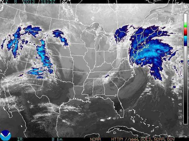
Modern meteorology relies on supercomputers to crunch the numbers from a staggering number of data sources. Observations from weather stations, balloons and radar are added to reports from commercial planes, special reconnaissance planes, ships and satellites, just to name a few.
“Satellites can tell you what the wind is doing,” Weather Underground meteorologist Jeff Masters explained in a phone interview on Thursday. “They can track clouds and ascertain wind velocity, and they also have sounding instruments that can tell you the temperature and moisture beneath them.”
One of the primary mathematical tools in computer weather modeling is partial differential equations, which calculate how characteristics of the atmosphere are likely to change from their present states. But these kinds of equations are extraordinarily complex and have no exact solution, which is one reason why forecasts can't look ahead too far into the future -- the little errors and uncertainties in the math start to add up after several days.
The National Weather Service has its own computer forecasting system, but the model with the biggest muscle belongs to the European Center for Medium-Range Weather Forecasts. The ECMWF is based in Reading, England, and draws on the computing power of one of the largest supercomputer complexes in Europe, capable of a computing power equal to 600 teraflops, meaning that the system can perform 600 trillion "floating point operations" per second, which is substantially more math than any human can perform.
“The European model has higher resolution -- it subdivides the atmosphere into smaller grid squares,” Masters said. “You can see more detail, and usually it is the most accurate model we have.”
The high resolution of the ECMWF model means it's much better at what's called initialization -- the entering of initial atmospheric conditions that the forecast is built upon.
“The U.S. model takes 'snapshots' of data, builds a global picture (the initial conditions) and then begins the forecast simulation,” Ars Technica writer Scott K. Johnson explained last December. “The ECMWF model, on the other hand, takes continuous observations spanning half a day, runs the model with that real data and then sets it loose on the future.”
Last October, a week before Superstorm Sandy made landfall in New Jersey, the NWS forecast model showed there was a chance that the storm would hit the Northeast but predicted that it was more likely to head out into the Atlantic Ocean. The European model, however, thought differently. Eventually, the NWS model aligned with the European forecast, but not for several days.
There are some upgrades to the U.S. model planned for later this year, but even then the Europeans will still be out-muscling the NWS. But the more worrisome issue is the aging of many American weather satellites, which are crucial for both the NWS and the ECMWF number-crunchers.
In November, ECMWF ran an experiment where they reran their model with the data available five days before Sandy made landfall, but with one key difference: They omitted the observations from NASA's polar-orbiting satellites, which loop around the Earth from the North Pole to the South Pole. There's a very real chance that some of those satellites might not be functioning at full capacity later this decade.
Without the polar-orbiting satellite data, the European model failed to predict that Sandy would turn back toward New Jersey. Other experts point out that not all of NASA's polar-orbiting satellites are likely to fail at once, so the ECMWF experiment represents an extreme scenario. Satellites from other countries could fill the gap in NASA data. But the experment underscores just how slim a margin the weather forecast balances on.
Winter weather is very different from hurricanes and harder to predict. Rather than a clearly defined storm, winter storms are broad, chaotic systems. Sometimes a winter storm is the product of a couple of systems -- Nemo was spawned by the mating of a fast-moving blast of cold air called an Alberta clipper with a warm, moist system driving up from the southern U.S.
Even just over a few days this week, one could see the constant refinement of the forecast as the new data poured in: At first, New York City was going to just get a couple inches courtesy of Nemo, then six or so, then, on Thursday, the NWS issued a blizzard warning.
“It's hard to forecast these sort of storms, because, if they change their track by 100 miles, it can change from rain to snow,” Masters said.
But dealing with the capriciousness of nature is just part of the job for your friendly neighborhood weatherperson -- and his or her trusty supercomputer.
© Copyright IBTimes 2025. All rights reserved.
- MOST POPULAR IN Science


