Hurricane Dorian Update: Storm Reaches Category 5 As It Nears Landfall
[Update: 4:08 p.m. ET.The National Hurricane Center reports that wind gusts have reached over 220 mph on the Abaco Islands in the northern Bahamas and east of southern Florida. The NHC called the situation "life-threatening."]
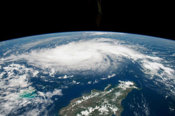
The National Hurricane Center (NHC) has reported that Hurricane Dorian has intensified into a powerful Category 5 storm as it nears landfall in the Bahamas, as of 8 a.m. on Sunday. The NHC said in a morning tweet that the storm is currently sustaining winds of 175 mph with gusts of 200 mph and will soon make landfall.
NEW: #Dorian is now a category 5 #hurricane with 160 mph sustained winds. The eyewall of this catastrophic hurricane is about to hit the Abaco Islands with devastating winds. Next advisory: https://t.co/tW4KeFW0gB pic.twitter.com/oFspgN0XbT
— National Hurricane Center (@NHC_Atlantic) September 1, 2019
“The eyewall of this catastrophic hurricane is about to hit the Abaco Islands with devastating winds,” the NHC tweeted. Later, the NHC added that the storm represented a “life-threatening situation” and urged residents of the Bahamas to take shelter immediately.
“Theses hazards will cause extreme destruction in the affected,” the center tweeted around 9:30 a.m. “And will continue for several hours.”
The center’s most recent update on social media from 9:30 a.m. on Sunday put Dorian roughly 25 miles, or 40 km, east-north-east from the Great Abaco Island, and 210 miles east, or 340 km, east of West Palm Beach, Florida.
With Dorian expected to hit Florida within 36 hours, Palm Beach County has issued a mandatory evacuation order for its residents.
According to county officials, residents of Zone A and Zone B structures must be evacuated by 1 p.m. Zone A structures include mobile homes and other sub-standard housing options, while Zone B includes barrier islands and other homes near vulnerable waterways. This leaves most of the county not evacuated and those left are being advised to seek shelter.
© Copyright IBTimes 2026. All rights reserved.
- MOST POPULAR IN World