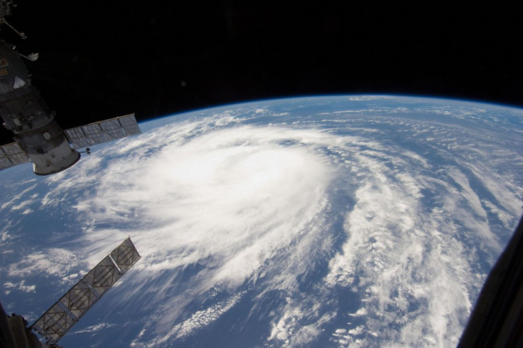
Hurricane Katia: Why Is the 2011 Atlantic Hurricane Season So Active?

From 2004 to 2008, with a brief respite in 2006, the United States was slammed with one major hurricane after another: Hurricanes Ivan, Katrina, Rita, Wilma and Ike, to name the most infamous. Then there were three years of quiet, in which no hurricane made landfall here.
But this year, the Atlantic hurricane season has been jam-packed, with 12 named storms in three months and a 13th on the way if Tropical Depression 13, currently moving through the Gulf of Mexico toward New Orleans, becomes a tropical storm. For perspective, that is the total number of named storms seen in a normal six-month season. Only two, Irene and Katia, have been hurricanes -- the rest remained tropical storms or tropical depressions -- but with the season only half over, more will certainly form.
Why is the 2011 season proving more active than the 2009 or 2010 seasons? Why were those seasons less active than the ones from 2004 to 2008? And what accounts for the anomaly of 2006 after the record-shattering 2005 season?
Typical explanations for the season-to-season variance in hurricane frequency and severity are El Niño or La Niña, which are periodic phenomena characterized by unusually warm or cool temperatures in the equatorial Pacific Ocean, respectively. They affect weather patterns worldwide, including the formation of Atlantic hurricanes. Climatologists believe El Niño increases the frequency of hurricanes in the Pacific Ocean and decreases the frequency in the Atlantic Ocean, and vice versa for La Niña.
But this year, there is only a very weak La Niña, so how to explain the unusually active season?
So far this season, the structure of winds in the upper levels of the troposphere has allowed more storms to form, Corene Matyas, a hurricane expert at the University of Florida, told IBTimes. The tropical Atlantic has experienced wind shear that is below normal. High wind shear prevents tropical systems from forming or weakens them if they do form. In addition, there has been more moisture than normal in the middle and upper levels of the troposphere over many parts of the Atlantic basin.
Merriam-Webster defines wind shear as a radical shift in wind speed and direction that occurs over a very short distance, either east-west or north-south. Tropical storms and hurricanes gain strength from the heat released by the condensation of water vapor into liquid, according to Weather Underground, and wind shear inhibits this process by removing heat and moisture and by distorting or tilting a storm's vortex. A tilted vortex is usually a less efficient heat engine -- the delicate balance of inflowing low-level winds and outflowing upper-level winds that ventilate the storm gets disrupted, the Weather Underground Web site says.
The terminology is a bit dense, but the point is simple: wind shear weakens the forces that power tropical storms and hurricanes, and wind shear is low this year, so more storms have been able to form uninhibited.
A much longer-term factor is the Atlantic Multidecadal Oscillation, which is a natural cycle of sea surface temperature fluctuation that lasts 20-40 years on average, Matyas said. The AMO has been linked to hurricanes in the Atlantic basin as well as rainfall and temperature patterns. So the hurricane activity that has occurred since 1995 in the Atlantic basin has been more active than during the 1970s and 1980s.
But wait, one might ask -- if this hurricane-producing phase has been going on since 1995, what accounts for the huge year-to-year differences in activity?
There can still be year-to-year fluctuations in activity, Matyas said. Recall that in 2006, forecasters expected an active season on the heels of the record-breaking 2005 season. However, an unexpected El Niño developed, and this condition is associated with lower than normal hurricane activity in the Atlantic.
That is to say, the AMO has caused the hurricane seasons since 1995 to be more active on average than the seasons before 1995, but within that broader climate, factors like El Niño can have a substantial effect on how many storms develop from year to year. This makes it difficult to predict reliably how active coming hurricane seasons will be.
Due to the AMO cycle, it is likely that hurricane activity will be above normal on average over the next decade or so, Matyas said, but some years could still have below-normal activity within this time period.
© Copyright IBTimes 2025. All rights reserved.


