NASA Satellite Spots Burn Scars In California

KEY POINTS
- A NASA satellite spotted extensive burn scars in California
- Apart from the wildfires, the smoke and burned land pose other problems
- Burned land typically becomes rather water repellent, increasing flash flood risks
Satellite images have spotted burn scars left behind by the wildfires in California.
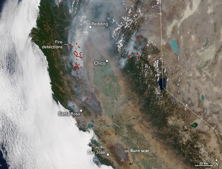
After over a week of fighting hundreds of wildfires, better conditions are now helping firefighters to have better control over the events. The wildfires have already burned over 1 million acres of land and resulted in substantial burn scars that were spotted by the Moderate Resolution Imaging Spectroradiometer (MODIS) instrument aboard NASA's Terra satellite.
In the first of two satellite images shared by NASA Earth Observatory, the red dots mark fire detections that were deemed as "active" while thick smoke can also be seen still rising from these areas, covering the areas with marked burn scars. This smoke has also become a public health crisis that has spread beyond the state.
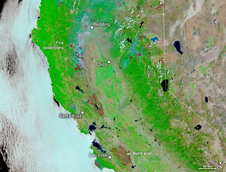
In the false-color image, the burn scars are more apparent as they are seen in brown, indicating the burned vegetation, while the bright green areas represent the unburned vegetation. These burn scars can be seen in several areas, with the more extensive scars observed close to San Jose and Santa Rosa.
The wildfires have also led to other problems as the smoke from the wildfires has significantly degraded the air quality, not just in California but in other parts of the country as well.
These charred lands may also pose another problem for Californians: flash floods. According to the National Oceanic and Atmospheric Administration (NOAA), rainwater that typically gets absorbed by the land instead runs off quickly after wildfires because the burned soil becomes rather water repellent, placing downhill and downstream areas susceptible to flash floods.
This is particularly problematic for California since, according to the Public Policy Institute in California (PPIC), it is considered to be a flood-prone state, with every county having been declared a flood disaster area multiple times. The state's many valleys are said to be especially prone to flooding and overflowing rivers.
Unfortunately, it sometimes takes years before burned vegetation could be reestablished so people should be prepared, especially since floods usually give little time to react once the rains start.
"A good rule of thumb is: 'If you can look uphill from where you are and see a burnt-out area, you are at risk,'" the NOAA said.
© Copyright IBTimes 2026. All rights reserved.
- MOST POPULAR IN Science