How Climate Change Will Affect Your Neighborhood: Check Out This NOAA Tool

If you want to know how climate has changed and will change in your neighborhood, the Climate Explorer, a tool provided by the National Oceanic and Atmospheric Administration, will let you see the transformations.
The Climate Explorer, a research application on the U.S. Climate Resilience Toolkit site, lets you see how climate conditions in certain locations may change over the next several decades.
Read: Climate Change Effects: Carbon Dioxide Hurts Algae The Ocean Needs
The data is broken down by graphs and maps of observed and projected temperature, precipitation and other climate variables. The information is available for every county in the United States.
The charts show historical averages (1950-2010) and projections for two possible scenarios. The future scenarios are based on whether humans moderately attempt to reduce global emissions of heat-trapping gases, and how the future will look like if humans carry on and do nothing about climate change.
Here’s how the temperature graph looks like for New York City:
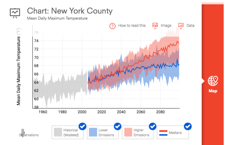
On the graph, you can see the stark difference between both scenarios in the next several decades. Projected temperatures for a future with humans trying to reduce global emissions is highlighted in blue while the scenario in which people do nothing is highlighted in red. The projected temperatures are provided until 2099.
Read: NASA Research: Survey Of Greenhouse Gas Levels To Help Predict Climate Change
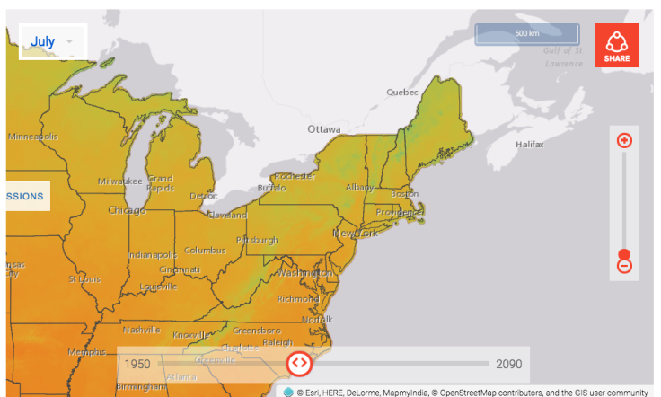
If you click on the right side of the chart, you’ll be able to see a map of the location in which you are interested. You can click on "full map" to see a bigger version on your screen and look up your neighborhood on the left-hand side.
On the map, there is a toggle that lets you choose what decade you want to examine.
Here’s the temperature in July 2010:
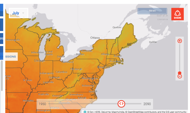
Here’s how temperature will change by July 2060 will change by 2060 with higher emissions:
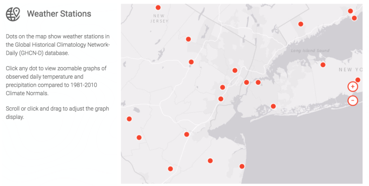
The averages of climate observations for 1950 to the early 2000s are based on data from ground-based weather stations across the country. When you look up a location, you’ll be able to see a map with red dots that label weather station sites.
The site also lets you save data by downloading graphs and CSV files.
“Individuals, businesses and communities of all sizes can use the Climate Explorer to understand how climate conditions in their location may change over the next several decades,” the site says. “This information — derived from global climate models — can help them make decisions and build resilience to extreme events.”
The tool was unveiled after NASA, NOAA and the World Meteorological Organization officially declared 2016 the hottest year on record. Last year’s record surpassed 2015 and 2014 temperatures, making it the third consecutive year of record-breaking numbers.
© Copyright IBTimes 2026. All rights reserved.
- MOST POPULAR IN Technology