

How High is Mt. Everest? China and Nepal's Mountain-Measuring Contest
To settle a dispute with China, Nepal is remeasuring the height of Mount Everest, the highest mountain on Earth.
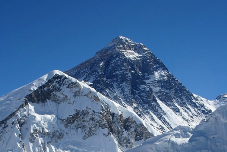
Everest sits on the border between Nepal and China, but the two countries disagree on the height of the mountain by four meters. The official, internationally accepted height is 8,848m (29,029ft), based on a 1955 Indian survey, but China claims the Himalayan peak is shorter.
The discrepancy in is the details. China believes that the measurement should not include the snow cap atop the mountain. Nonetheless, in China's last survey, including the snow, they still disagreed with the Indian standard by seven centimeters.
We have begun the measurement to clear this confusion. Now we have the technology and the resources, we can measure ourselves, Gopal Giri, a spokesman with the Nepalese land reform and management ministry, told AFP. This will be the first time the Nepal government has taken the mountain's height.
The project will take up to two years. The government must establish reference points on the mountain to calculate the size of Everest using GPS satellites.
The United States measured the height at 8,850m in 1999 using a GPS system.
No matter what Nepal finds the actual height to be, it still won't be a permanent benchmark. Mt. Everest's height is constantly changing thanks to shifts in continental plates. The Indian Plate is being forced under the Eurasian Plate, causing the Himalayas to rise higher. The peak of Everest gets millimeters higher each year.
© Copyright IBTimes 2025. All rights reserved.
- MOST POPULAR IN Technology


