

Hurricane Gonzalo Update: Bermuda Declares Hurricane Watch, Storm Could Reach Category 4 Winds

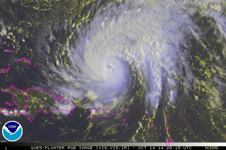
Hurricane Gonzalo continued on its path toward Bermuda on Wednesday with sustained winds of up to 125 mph, the U.S. National Hurricane Center in Miami said. The Category 3 storm could become even stronger throughout the day, experts warned.
“Gonzalo is now a Category 3 hurricane on the Saffir-Simpson hurricane wind scale,” the National Hurricane Center said in an advisory message, according to the Times-Picayune in New Orleans. “Additional strengthening is forecast during the next 48 hours, and Gonzalo is expected to become a Category 4 hurricane on Wednesday.”
As of Wednesday morning, Hurricane Gonzalo was located about 665 miles south-southwest of Bermuda and moving toward the island at about 13 mph, the Associated Press reports. Bermuda’s government issued a hurricane watch, urging citizens to track the storm’s progress and take necessary precautions.
The hurricane passed through the islands of St. Maarten and Antigua on Tuesday, killing one man and injuring 12 others while causing structural damage to many homes, the Weather Channel reports. Puerto Rico experienced power outages, but did not suffer any major damage.
“It was a big storm, much bigger than people predicted, and a lot of bad things happened,” Susan Cuniff, a hotel manager in St. Maarten told the Weather Channel. “Boats crashed into each other, and trees were downed. And even the zoo was decimated.”
Hurricane Gonzalo is expected to make landfall in Bermuda by Friday. If it becomes a Category 4 hurricane as expected, it will be the strongest storm seen in the Atlantic Ocean since 2011, ABC News notes.
© Copyright IBTimes 2025. All rights reserved.
- MOST POPULAR IN Science


