Hurricane Irene: New York City Subway, JFK, LGA Airports to Close By Noon
Federal officials have warned Irene, which is at a category 1 phase currently, could cause flooding, power outages, storm surges or worse all along the East Coast as far north as Maine, even if it stays offshore.
Mayor Bloomberg asked that all residents be out by 5 p.m. on Saturday morning, saying, If you can leave today, that would be helpful.
John F. Kennedy and LaGuardia Airports announced closure Saturday morning at noon, along with the entire MTA New York City subway system.
Fares on New York City bridges and tolls will be suspended throughout the day, city officials say.
At the moment the strongest winds are expected to arrive in the early evening tomorrow. It is expected to be a category 1 storm. The full brunt of the storm — if you are in its way — is a lot more powerful than any of us, Bloomberg adds.
According to Gothamist, that's an estimated 250,000 residents of New York City.
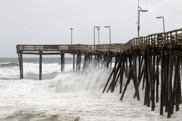
Hurricane Irene's path strengthened to a Category 3 hurricane overnight while passing over the Bahamas on Wednesday. Tuesday morning, the then-Category 2 storm had about 100 mph winds, according to the U.S. National Hurricane Center in Miami.
The storm, which weakened to a category 1 with 85 mph winds on Saturday, is expected to continue trudging northward.
For residents in states that may be affected later this week, it's critical that you take this storm seriously, said Craig Fugate, head of the Federal Emergency Management Agency.
Evacuation points of the city include Brooklyn's Coney Island and Manhattan Beach, Broad Channel in Queens, South Beach, Midland Beach, areas on Staten Island, and Manhattan's Battery Park City.
Officials say the projected path has gradually shifted to the east, though Irene is still expected to make landfall as a major hurricane in North Carolina this weekend.
An image released by the NOAA made from the GEOS East satellite shows Hurricane Irene, Aug. 24, 2011 as it creeps up the East Coast with its harsh winds and disastrous nature.
The last hurricane to make landfall in the U.S. was Ike, which pounded Texas in 2008, experts say.
Although, this storm is reportedly moving to the west-northwest near 10 mph, with an expected turn toward the northwest on Wednesday.
East Coast residents are stocking up on bottled water and plywood, and this week Hurricane Irene began trending on Twitter, with many users sharing updates on the storm's progress while others hoped it wouldn't come their way.
© Copyright IBTimes 2026. All rights reserved.
- MOST POPULAR IN Society