Hurricane Irene Path Update: Boston, Hartford, New York, Philadelphia, Washington Remain Targets

Hurricane Irene continued on a path Friday toward creating havoc in the upper U.S. East Coast, striking or heavily impacting cities including Boston, Hartford, New York, Philadelphia, and Washington, D.C.
The storm poses an extraordinary threat and will begin impacting North Carolina coastal areas late Friday before ravaging the U.S. Mid-Atlantic, Northeast and New England regions, likely assaulting major metropolitan areas including New York, Hartford, Washington, Boston and Philadelphia.
Updated models Friday suggest specific timing will be: Virginia (late Saturday); Washington, D.C. (late Saturday); New York (late Saturday through Sunday); and Boston (Sunday).
Called by one weather expert as potentially the storm of a lifetime for the upper U.S. East Coast, Hurricane Irene poses extraordinary threat to the Mid-Atlantic and Northeast United States beginning late Friday and into Monday, weather forecasters said.
Irene weakened slightly Friday morning but the storm remains a high-end Category 2 and is expected to re-strengthen later today into a Category 3 storm before assaulting the Mid-Atlantic, Northeast, and New England. Major metropolitan areas that rarely get hit by a storm of hurricane strength are in the line of fire.
In fact, the entire highly populated I-95 corridor up the U.S. East Coast faces potentially a storm of a lifetime as Irene makes a path up the coast beginning Friday and into the end of the weekend.
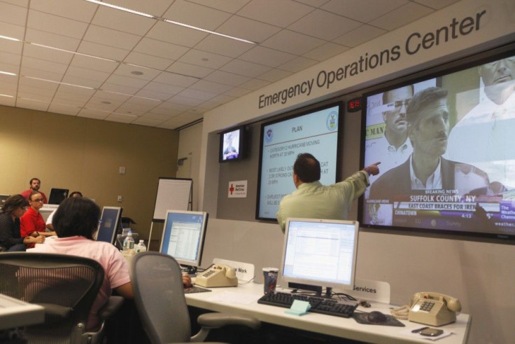
States of emergency have been declared from North Carolina to Virginia, New Jersey and New York. On Friday, models still showed Irene might make a direct hit on New York, America's largest city. New York Mayor Michael Bloomberg, who faced criticism during the administration's slow response to a blizzard in December, visited flood-prone parts of Queens Thursday to outline comprehensive hurricane response plans for the city.
Bloomberg said he could decide as early as Friday night to evacuate New Yorkers at risk in low-lying areas, including Coney Island in Brooklyn, and that the city's transportation system could be shut down if forecasts continue to suggest New York will get hit hard by Irene.
Current forecast models updated Friday show Irene is likely to make landfall in the Mid-Atlantic region by early Sunday morning as a strong Category 2 storm with winds of 100 miles per hour or more before reaching New York -- and possibly making a rare direct hit on the city late Sunday while still at hurricane strength.
Weather experts are labeling Irene an extraordinary threat from eastern North Carolina to southern New England.
This is a particularly threatening situation and it's best for people to be on alert, said Dr. Rick Knabb and senior meteorologist Stu Ostro at The Weather Channel.
Computer models are trending toward a forecast solution of rare potency for portions of the Northeast, according to the The Weather Channel experts. They say Irene will be a serious and multi-hazard threat for the major metropolitan areas which include major cities Norfolk, Washington, D.C., Baltimore, Philadelphia, New York City, Hartford and Boston.
Residents can expect downed trees and power lines, flooding, high winds and power outages, with significant impacts of surge and high waves and beach erosion along coast lines.
Irene will come close to the North Carolina coast late Friday night, with impact through Saturday. Northeast impacts will last through Monday as the Irene drops to tropical storm strength before departing the U.S.
The center of Irene is forecast to make landfall as a borderline Category 2 or Category 3 storm Saturday morning in eastern North Carolina, most likely between Morehead City and Hatteras. Tropical storm conditions are possible as far inland as I-95 in North Carolina, with hurricane conditions extending up to 40 miles away from the North Carolina coast.
Parts of Highway 12 in North Carolina's Outer Banks are likely to be washed away from the storm from surge and lashing waves.
Rain and wind is forecast to pick up in eastern Virginia late Friday night and into Saturday, before advancing up to Maryland, Delaware, and southern New Jersey Saturday. Hurricane conditions will be likely along the coastal line of these states, with tropical storm conditions likely as far inland as I-95.
Inland areas of Pennsylvania and Baltimore and Washington, D.C. are likely to experience tropical storm conditions with heavy, pounding rains and wind. Flashing flooding will be possible, as will power outages.
By late Saturday night and into Sunday, the New York metropolitan area will experience its worst conditions, with destructive wind, heavy flooding rain and storm surge with coastal flooding. Power outages will be likely and tropical storm conditions will extend inland into western New Jersey and upstate into the Hudson River Valley.
© Copyright IBTimes 2024. All rights reserved.


