

Hurricane Irene Starting Path Up East Coast: 'Extraordinary' Threat Leads to Evacuations, Preparations
See the IBTimes Interactive Update Map Below
Hurricane Irene is starting its path to the U.S. East Coast, and sharpened forecasts suggest the storm could be extraordinary for millions of residents from Virginia to New York and into New England by late Sunday.
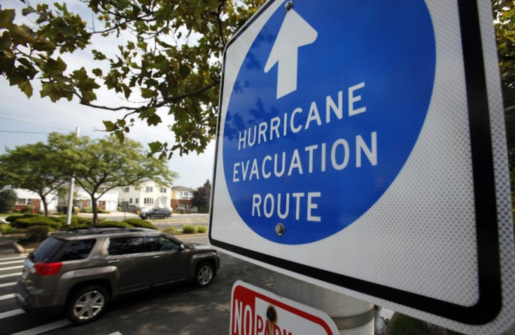
Evacuations were under way from North Carolina to Delaware Friday. Schools and businesses along the path planned shutdowns and many made grocery runs, preparing to hunker down.
The first hurricane set to make U.S. landfall since Ike in 2008, Irene poses a significant threat from North Carolina to the Mid-Atlantic to the Northeast and New England -- a threat that many in the region have never before seen in their lifetime.
(See the IBTimes interactive map with specific updates for your region, below.)
At 11 a.m. ET Friday, the center of Hurricane Irene was located 330 miles south-southwest of Cape Hatteras, N.C., with winds near 105 miles per hour. The massive storm is moving north at 14 miles per hour. Some of the outer rain bands from Irene will start hitting coastal areas of Georgia, South Carolina and North Carolina late Friday afternoon and Friday night.
The center of Irene is expected to make landfall as either a Category 2 or Category 3 storm on Saturday in eastern North Carolina, most likely between Cape Hatteras and Morehead City. Tropical storm conditions are possible as far as 40 miles inland.
Then, Irene will pound eastern Virginia late Friday night and into Saturday before heading up through Maryland, Delaware and southern New Jersey later Saturday. The storm is forecast to still be at hurricane strength, causing flooding, downed trees and power outages with high winds and rains.
All the major metropolitan areas along the northeast are going to be impacted, National Hurricane Center Director Bill Read told Reuters Insider. Being a large hurricane, tropical storm-force winds will extend far inland.
Along coastal areas, storm surge could cause severe flooding, but even inland areas will experience flooding from heavy, sustained rainfall.
There's going to be flooding, there's going to be heavy rain, said National Weather Service Meteorologist Mike Rusnak, in the Virginia Pilot. It's just a matter of the exact track because it's still two days out and it's still too early to try to figure out out what kind of numbers to give here.
Weather experts are labeling Irene an extraordinary threat from eastern North Carolina to southern New England.
This is a particularly threatening situation and it's best for people to be on alert, said Dr. Rick Knabb and senior meteorologist Stu Ostro at The Weather Channel.
In New Jersey, evacuation plans were being reviewed, sandbags were being prepared and residents were being cautioned, while in New York, Mayor Michael Bloomberg sought on Thursday to establish plans in the effort to avoid controversy that erupted late last year after the city's disastrously slow response to a historic blizzard.
Irene weakened slightly Friday morning but the storm remains a high-end Category 2 storm, and is expected to re-strengthen later today into a Category 3 storm before assaulting the Mid-Atlantic, Northeast, and New England. Major metropolitan areas that rarely get hit by a storm of hurricane strength are in the line of fire -- including New York, which could take a direct hit.
Bloomberg said he could decide as early as Friday night to evacuate New Yorkers at risk in low-lying areas, including Coney Island in Brooklyn, and that the city's transportation system could be shut down if forecasts continue to suggest New York will get hit hard by Irene.
Computer models are trending toward a forecast solution of rare potency for portions of the Northeast, according to Weather Channel experts. They say Irene will be a serious and multi-hazard threat for the major metropolitan areas which include major cities Norfolk, Washington, D.C., Baltimore, Philadelphia, New York City, Hartford and Boston.
© Copyright IBTimes 2024. All rights reserved.
- MOST READ


