

Hurricane Katia Path 2011: Storm to Target Northwest Europe, Norway
Hurricane Katia's path will impact northwest Europe as a extra-tropical storm Sunday to Tuesday, forecasters say, with gales and heavy rain spreading from Ireland and Scotland starting late Sunday through Tuesday.
Hurricane force gusting winds will be possible, especially along the northern shores and over hills. England and Wales will also experience gale-force winds, with some rainfall, according to the latest forecasts.
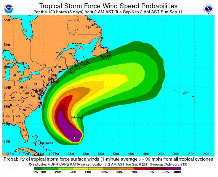
The U.S. and the east North American Coast however, will be spared from Katia's path, except for some coastal areas from northeastern Florida to Newfoundland that are likely to experience rough seas and surf as the storm passes by in the next few days.
Currently a Category 2 storm, forecasters say Katia could strengthen to become a Category 4 storm by Monday, but then Katia will enter cooler waters and wind shear that will result in weakening.
Katia will near the U.S., but models are consistent in showing that the storm will turn to the north, remaining east of North Carolina's Outer Banks. Cape Cod, Nova Scotia and Newfoundland -- points of land that stick out into the Atlantic -- could experience the most impact of rough seas and surf.
But in Europe, even the mainland will be impacted by Katia eventually, as northermost France, the Netherlands, and Denmark will experience wind and some rain as a result of the storm. Norway is also likely to get significant impact from the storm.
It's rare that tropical cyclones reach Europe, but Norwegian forecasters warn that Katia could reach Norway on Tuesday or Wednesday of next week, with heavy rains and winds from the storm, extra-tropical at that point.
© Copyright IBTimes 2024. All rights reserved.
-

Self-care: Orangutan Seen Apparently Treating Wound
-

European Court Upholds Italy's Claim To Greek Bronze In US Museum
-

Colombian School, A Grim Reminder Of Atrocities Of Rubber Fever
-

More War Debris In Gaza Than Ukraine: UN
-

UK Confirms First Migrants Held For Rwanda Deportation Flights
-

Tesla To Cut Hundreds More Jobs In Musk Cost Push: Report
-

Microsoft Is Turning Into The 'Maestro' Of AI Transformation
-

US-Japan-Philippines Alliance: A Trio With Bitter Past Now Threatens China's Maritime Ambitions
-

Abu Dhabi-backed Group Ends Telegraph Takeover Bid
-

New Post-Brexit Controls: A Thorn For UK Horticulture


